

This item is no longer available.
Capturing geo-data including actual address has never been so simple!
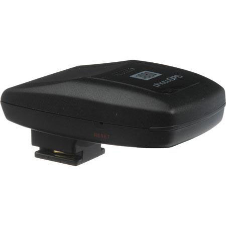
Mount the JOBO photoGPS on your camera's hot-shoe and capture the geo-data of each picture by the click of your camera instantaneously and automatically. Coordinate the geo-data and your pictures on the PC or laptop, using the supplied software.
In addition to the longitude and latitude, the address i.e. country, city, street and closest point of interest is captured in the image file. This enables you to search for specific places, streets or POI without having to tag each picture individually. Software is also included to organise, find and sort pictures. (This feature and it's accuracy varies by country and is not available for oceans, arctic regions and Non and near non populated land mass area. It provides reverse geocoding to street level in major towns/cities and to major road level elsewhere for the following countries: Estonia, Finland, France, Germany, Gibraltar, Greece, Hong Kong, Hungary, Indonesia, Italy, Liechtenstein, Lithuania, Luxembourg, Malta, Mexico, Monaco, Netherlands, Norway, Poland, Portugal, San Marino, Singapore, Slovakia, Slovenia, South Africa, Spain, Sweden, Switzerland, Taiwan, United Kingdom, United States, Vatican City. it will reverse geocoding to town level and may provide to street level for the following countries: Bosnia and Herzegovina, Bulgaria, Egypt, Ireland, Kuwait, Latvia, Malaysia, Oman, Macedonia, Saudi Arabia, Qatar, Serbia, Russia, Turkey and Un ited Arab Emirates - Listing is provided by Jobo as of May 2009)