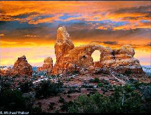
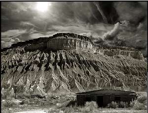
Stunning vistas, amazing panoramas, breataking geological phenomena and much more await in the Grand Circle, a string of national parks that covers five southwestern states. Is this the ultimate photography road trip?
The Grand Circle is a vast region covering parts of five states: Utah, Arizona, Nevada, Colorado and, New Mexico. It contains America’s largest concentration of National Parks and Monuments all connected by hundreds (Maybe thousands) of miles of roads designated as Scenic Byways. The opportunities for amazing landscape photography abound here. If you’re planning a road trip this summer, this is an awesome option. Come with me for this, the first of a two-part series where we travel and photograph some of the greatest scenery the United States has to offer.
The National Parks and Monuments included here are Zion, Bryce Canyon, Cedar Breaks, Capitol Reef, Arches, Canyonlands, Grand Staircase/Escalante, Monument Valley Tribal Park, Grand Canyon National Park (Both the North and South Rims), Lake Powell Recreation Area, Great Basin, Canyon De Chelly, Mesa Verde, Pecos National Historical park, Petrified Forest, and the Black Canyon of the Gunnison. There are also many state parks, and don’t miss the slot canyons of Page.
The Best $80 You’ll Spend On This Trip
Brilliant red rocks, fascinating geologic shapes, and the ruins of ancient cultures fill the area with some of the best photo opportunities in the world. This is one of the best road trips in the US! This is such a huge subject, I’ve divided this article into two parts. Right now I’m going to concentrate on the ones in Utah and Northern Arizona. And the best tip I can give you is to buy the National Park Pass. For $80 it will get you into everything mentioned here except the state parks and Monument Valley Tribal Park. If you are 62 or older you can get a lifetime pass for $10. With the larger parks charging an entrance fee of $20-25, you quickly be saving lots of dollars buying the pass if you plan on hitting all the parks in this area. It is available at any of the National Parks right at the entrance fee station.
What’s in My Camera Bag?
All images in this article were shot with digital cameras except for one of Bryce Canyon, which was shot with a Widelux F7 Panorama film camera. The majority of the other images were taken with a Nikon D300 or Nikon D300s. A couple were shot using an old Olympus Evolt 300. Lenses ranged from a Nikon 12-24mm f/2.8G ED-IF AF-S Zoom Nikkor to a Nikon 500mm f/4G ED AF-S VR II prime. Most were shot on a Gitzo Carbon Fiber tripod such as the Gitzo Moutaineer 6X, and Induro Ball head or a Manfroto Carbon Fiber Monopod with a Giottos ball head. All were processed using Adobe Lightroom and Adobe Photoshop on PCs I built myself. My prints are always made using Epson printers such as the Epson Stylus Pro 3880, and Ilford papers, my favorite being ILFORD Gold Fibre Silk. I find the absorption properties of the paper, combined with the slight gloss surface, showcases my work the best.
Living in California, my Grand Circle adventure takes me through Las Vegas. As a photographer there is plenty of good subject matter there but my wife and I usually save that for on the way home. It’s a great place to decompress after a week or more out in nature. This trip actually begins with a sunrise stop at Valley Of Fire State Park.

Arch, Valley Of Fire State Park, Nevada. Photo © R. Michael Walker.
Valley of Fire State Park
It’s about an hour outside Vegas heading east down the 15 near Overton, NV. Take exit 75 and turn right on to the Valley Of Fire Road. Continue down the road till you come to fee collection area. After that there are red rocks all around. There are lots of dirt roads heading out into the landscape. There is a visitor center on the left. That road continues on up into the hills, where a number of dramatic formations can be found. The main road hooks up with Northshore Road, which will get you back to Vegas via the shores Lake Meade. It’s longer, but the views are worth it. And if you happened to have spent the day and hit the crest of the hill around twilight, the view of the city is pretty amazing. But we’ll save that for the return trip as we are off the first of the national parks in the Grand Circle, Zion.
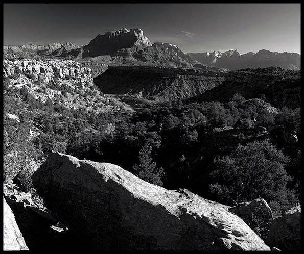
UT-9 out of Hurricane. Photo © R. Michael Walker.
Zion National Park
Heading East on I-15 will take us to the city of Saint George, UT. A few miles north of town you will see the turnoff for Zion. State road 9 winds through some great desert scenery and runs through the small town of Hurricane. Zion National Park is large, but the main parts are easily explored in a day or two. Now if you are an extreme hiker or you like to repel, this area could take a week to explore. I’m just not that adventurous so an afternoon and the next day is plenty for me.
The main city here is Springdale, UT. It’s quaint and the accommodations range from meager to 4 star. Unfortunately are all 4-5 stars, price-wise. More affordable accommodations can be had back in Hurricane or St. George. You can walk from your hotel to a park bus stop that will take you into the park itself. Cars do drive through part of Zion but mostly just to navigate the tunnel and climb out on the opposite side heading up towards Bryce and Capitol reef or south east towards Escalante or the Grand Canyon. Busses navigate all the park hot spots. Just jump off when you like. The next one will be along soon. To me, the best spots in the park that don’t require extreme measures to get to are the Emerald Pools across from the Lodge, the overlook after driving up the winding road through the tunnel and the Narrows, all the way at the end of the bus route in the park. For the truly adventurous and those not afraid of heights there is Angel’s Landing.
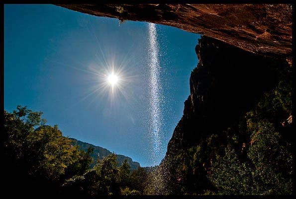
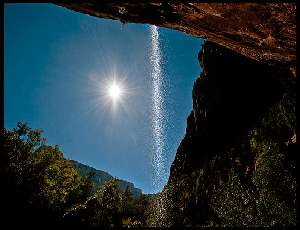
The trail up to the Emerald Pools takes you under the falls. This is a moderate hike. It gains a lot of altitude but you can get great shots without hiking all the way to the top. Photo © R. Michael Walker. Photo © R. Michael Walker
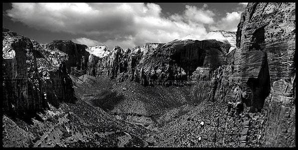
The overlook also requires a bit of a long walk but the view is worth it. Just take your time, especially along the narrow path about halfway there. Photo © R. Michael Walker.
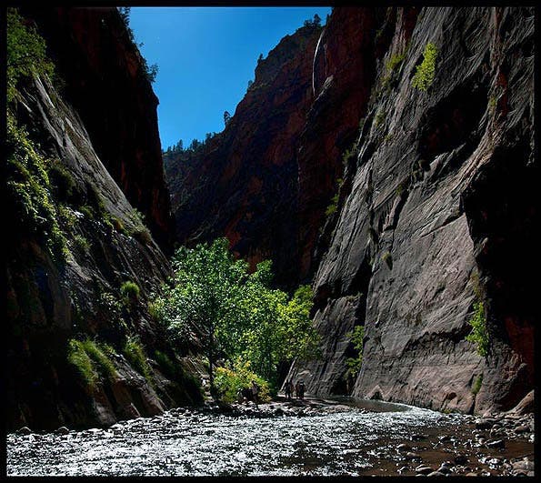
Photo © R. Michael Walker.
The hike up the Virgin River is the best reason to visit Zion, in my opinion. Whether you only go around the first bind or brave the entire trip up to the ranch, you will be rewarded with numerous photo ops. Be sure to take a hiking stick and wear comfortable shoes you can get wet in. I pack my photo equipment in waterproof bags inside my backpack just to be sure. Depending on the season, the water can be from a few inches to over your head so step carefully. You are also going upstream so that makes seeing the depth a bit tricky. And the rocks in the water are small and mostly round so footing can be precarious.
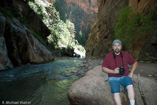
You WILL get wet. And You WILL love it as long as you are properly prepared. Photo © R. Michael Walker.
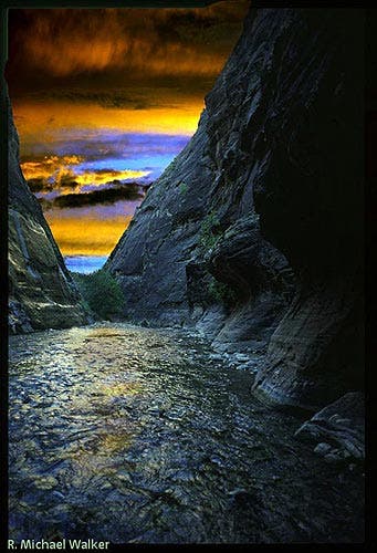
This image is a composite of several shots to get the contrast, detail and overall look I wanted. It was taken with a Nikon D300 and 12-24mm Nikkor lens. While I normally use a tripod for shots like this, hiking up the river carrying the extra weight was not feasible for me so I used a Monopod that could double as a second walking stick to stabilize the shots. Photo © R. Michael Walker.
Bryce Canyon National Park
Heading out of Zion on UT-9 East takes us up through the tunnel. The rocky wonderland gives way to a pastoral setting. It dead ends at UT-89. If you turn right you would be heading to Page, Monument Valley and the Grand Canyon. We are turning left and heading up to the spectacular red rock county that is Bryce Canyon. About 40 miles down the road we will turn off 89 onto UT-12. It’s clearly marked. You will know it when you start seeing the plentiful service providers near the junction. 15 miles don the road you will make a right turn onto UT-63 S. This will take you right into the park in about six miles.
The total driving time from Zion is only 90 miles, but takes 2-3 hours. Plan accordingly, because unless you are planning to spend several days here you will want to arrive before sunrise to get the best shots and maximize your shooting time.
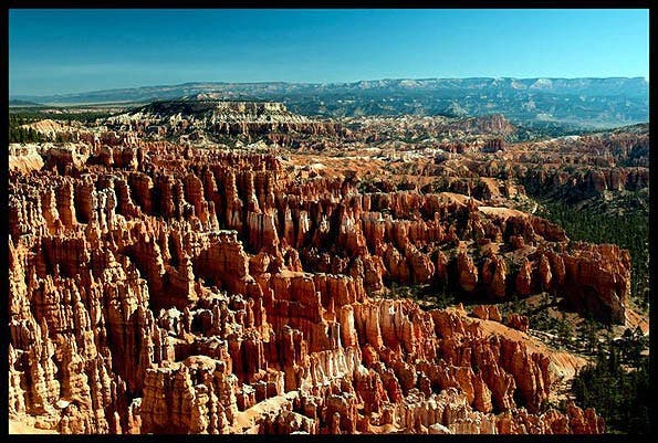
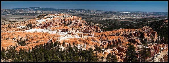
Bryce is known for it’s “Hoodoos”. These are large spires of red rock and they are plentiful! The park road can be a bit confusing and the drive out the Rainbow point is about an hour. Get the map when you pay your entrance fee and have someone navigate for you. The closer part of the park is the most colorful and will afford you the most photo ops anyway. I hit Sunrise point first (is that too obvious?) and yes there is a sunset point, too! This loop puts you closest to the Hoodoos and you can walk miles around the rim to get both the view and the light you want. Photo © R. Michael Walker
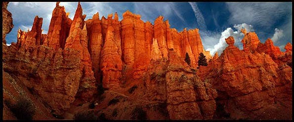
You can hike right down into them as well but remember, what goes down has to walk all the way back up too. Again, pace yourself accordingly. I made the hike when I was 30 and it whipped me. Now, at 61, I mostly stick to hikes around the rim. Photo © R. Michael Walker
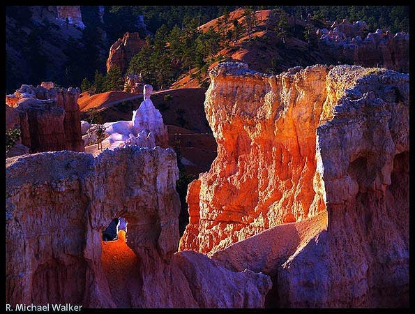
Paria view point is one of the few places where the Hoodoos face the setting sun. Bryce point is one of the best places to get a panoramic of all the Hoodoos at sunrise. Inspiration point allows you to walk out over the formations. All are easy hikes. Look to your visitor’s map for exact locations and parking. Photo © R. Michael Walker
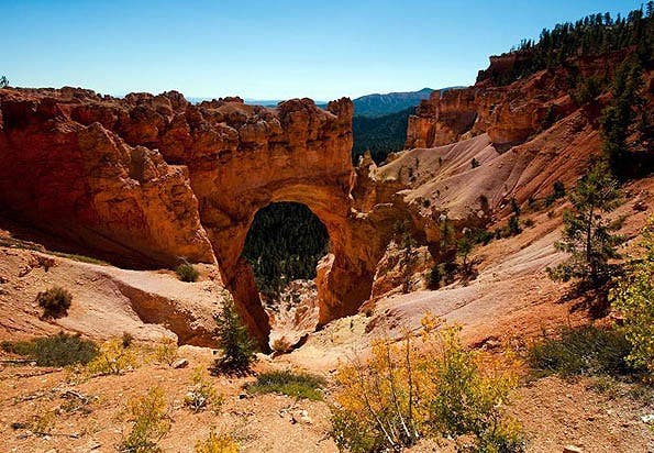
As you head out to Rainbow and Yovimpa View Points you will drive through Agua Canyon. There you will see Natural Bridge on your left. Though it’s a misnomer as it is actually an arch, it’s a striking formation. You are standing above it looking down. You’ll need good wide angle for this shot or seam a number of shots together to form a panorama. Continuing to the end of the road you will pass several other pull-outs for view spots. Photo © R. Michael Walker
Leaving the park the way you came in and heading on up N-89 you will go through the small town of Panquitch. It’s the only bargain in the area and still has a small town look and charm. There is a great small waterfall and cave on the road that is clearly marked, called Mossy Cave. Photo © R. Michael Walker
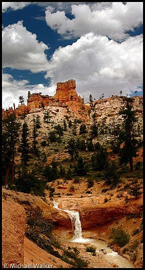
The waterfall and cave make a nice side trip and if you are planning on staying in Panquitch there is one more park you may want to consider. Photo © R. Michael Walker
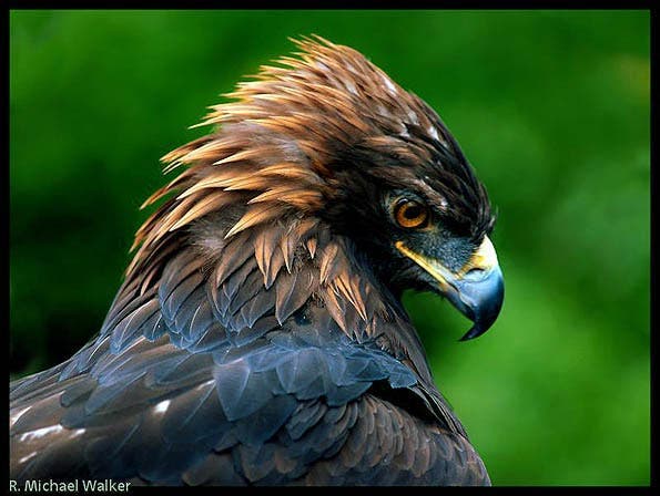
Cedar Breaks National Monument is less than 2 hours outside Panquitch. While it may pale next to what you see in Bryce there is abundant wildlife there. Less trails and less people means more animals. This Eagle was shot there with a simple 70-300mm VR zoom on my Nikon D300. Photo © R. Michael Walker
Grand Staircase-Escalante National Monument
You could also head on towards our next destination and stay in either Tropic or Escalante. Both are off UT-12E. Along UT-12E is Kodachrome Basin and the Grand Staircase/Escalante National Monument. After the beauty of Bryce Kodachrome is a bit of a let down but if you have the time it’s worth a few hours. Grand Staircase-Escalante is a 4WD wonderland..and a passenger car nightmare. There’s a lot of good hiking, biking and off-road adventures. It’s also way less populated than the other spots in the circle but for good reason. There are dirt roads a passenger car can safely navigate. You can enquire locally about road conditions if you want to brave the area sans 4WD. A good GPS and a local map are necessities, as are emergency supplies and a good spare.
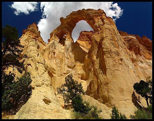
Grosvenor Arch is down one such road. It stands in the middle of a flat landscape like some man made monument. It’s a double arch made of red and white sandstone native to the area. It is right off the road—zero hiking required! It’s just a long, bumpy drive down a dirt road. Photo © R. Michael Walker
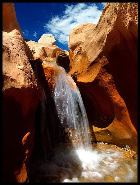
This parks contains waterfalls, Slot Canyons, and miles and miles of hiking and biking trails. Lower and upper Calf Creek Falls is beautiful and temperate. Summer temps soar so spring and late fall/early winter are the best times to visit. One problem then are the frequent storms. Rain and dirt don’t make for a good road trip in passenger vehicles, but the Photography can be spectacular. This is why I own a 4WD vehicle; if you’re flying in to the area and renting, consider renting a 4WD vehicle. Another plus here is the lodging: It’s not nearly as costly as around Bryce and Zion. Photo © R. Michael Walker
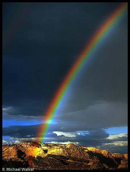
Rainbow Over Escalante. Photo © R. Michael Walker
That’s it for this article. Be sure to catch the next one in a few weeks! We will continue our journey with visits to Capitol Reef, Goblin Valley State Park, Canyonlands, Arches, Natural Bridges, Canyon De Chelly, Monument Valley and finish off at the Grand Canyon.
