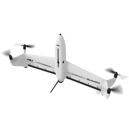
AeroVironment Quantix Mapper VTOL Hybrid UAV Drone System with Dual Cameras
SKU: AVQUANTIX
This item is no longer available.
Share:
Overview
Compare
Accessories
Specs
Protection

About AeroVironment Quantix Mapper
AeroVironment is thrilled to announce our exclusive cooperation with Draganfly, Inc. to sell Quantix Mapper hybrid VTOL drone and Quantix-related parts & accessories.
Quantix is a powerfully simple to use UAV empowering users through its fully-automated operation and instant insight. Its hybrid design allows the aircraft to launch vertically and transition to horizontal flight; maximizing aerodynamic efficiency and range. Users can immediately view high resolution imagery on the included Operating Tablet - no other devices, internet or additional software required.
With the touch of a button, users can quickly and safely generate up to date maps for in-field assessment. Whether assessing crop growth during key stages, or damage from storm, flood and fire, Quantix Mapper makes It easy to gather accurate images across a large area, assess and react to situation with precision and speed.
Features
Quick-Look HD
Immediately see centimeter-level accuracy without any additional devices, internet, or software
High-Powered Cameras
Built-in dual 18MP cameras capture high-res RGB and multispectral images to provide 4x the coverage of most quadcopters
Non-Proprietary Image Formats
Data is available in open file formats for easy integration into a wide range of GIS, mapping, and 3d modeling tools
Cameras
Simultaneously collects high-resolution RGB & Multispectral
Range (Liner)
2 km Radio Limit
Communication
900 MHz Encrypted & WiFi
Navigation
Fully Automatic Navigation
AeroVironment Quantix Mapper Features
- Fully Automatic - Safely collects hundreds of acres with simple user friendly inputs
- Quick-Look HD - Immediate access to georeferenced High-Resolution Images on tablet
- Adjustable Altitude - Simply change altitude to vary coverage rate and image resolution
- Non Proprietary images - Further analyze Quantix Mapper data with a wide range of tools