Drone Software
Save 5% Every Day† with the Adorama Edge Card. Learn More
Drone Software

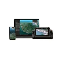
Skydio Drone as First Responder Plan for Skydio X10
SKU: SKYDR4DOKDFRMFR: DR4DOKDFRCR
- Boost DFR drone accuracy for precise missions.
- Effortless drone automation, superior control.
- Streamlined real-time mapping for X10 DFR.
- Seamless integration with Skydio DFR systems.
- Robust drone security ensures data integrity.
Special Order
?
Free Shipping

Skydio DFR Patrol Services and Premium Solution
SKU: SKYDR4PLDFRCMFR: DR4PLDFRCRMA
- Advanced DFR Patrol for enhanced security.
- Premium Skydio DFR solution; unrivaled tech.
- Seamless X10 Drone compatibility assured.
- Exceptional product quality & reliability.
- Streamlined DFR Patrol for optimal efficiency.
Special Order
?
+ wishlist
Ways to Save

DJI Terra Standard w/Modify Flagship 3D Modeling & Mapping Software, 1-Yr,Online
SKU: DJICPRJ24701MFR: CP.RJ.00000247.01
- Accurate 3D mapping with Terra Standard software.
- Efficient data processing for aerial intelligence.
- Real-time analytics for informed decision-making.
- Customizable mapping for diverse drone tasks.
- Seamless compatibility with DJI drone platforms.
New Item
?
Free Shipping

DroneSense Real Time Crime Center with FUSUS Integration
SKU: DSINTFUSUSMFR: DSINT-FUSUS
Download Version
- Enhance drone software compatibility seamlessly.
- Achieve superior flight stability with DroneSense tech.
- Real-time data analysis via DroneSense integration.
- Maximize GPS accuracy using advanced software.
- Optimize battery life with efficient drone software.
+ wishlist
Ways to Save
DJI FlightHub 2 Storage Space Upgrade Package
SKU: DJIFH2SSUPMFR: CP.RJ.00000104.01
- Enhance DJI FlightHub 2 with 500GB storage.
- Optimize drone software with expanded storage space.
- Ensure DJI FlightHub 2 compatibility, seamless use.
- Boost flight data storage for improved analysis.
- Upgrade drone software for enhanced data capacity.
Special Order
?
Free Shipping

DroneSense CloudStream for Dock
SKU: DSCSDMFR: DSCSD
Download Version
- Seamless drone data processing for quick insights.
- Real-time analysis ensures optimal flight stability.
- Enhance mapping accuracy with DroneSense CloudStream.
- Compatible with Nightingale & Fotokite drone docks.
- Easy-to-use interface for efficient drone operations.
+ wishlist
Ways to Save

DJI Terra Standard with Modify Flagship 3D Modeling, Perpetual License, Online
SKU: DJICPRJ23201MFR: CP.RJ.00000232.01
- Streamlined drone flight planning software access.
- Accurate mapping capabilities for data analysis.
- Real-time feedback enhances drone operations.
- Seamless compatibility with DJI drones guaranteed.
- Simplified drone software ensures ease of use.
Special Order
?
Free Shipping

Phoenix LiDAR LiDARMill Software, Annual Subscription, Download
SKU: PHLLMILLASUBMFR: 600151
- LiDARMill software: Streamline data processing.
- Annual subscription ensures continuous updates.
- Phoenix LiDAR software: Maximize mapping accuracy.
- Process LiDAR data with ease and efficiency.
- Enhance drone data security with robust tools.
Special Order
?
+ wishlist
Ways to Save

DJI Terra Standard 3D Modeling and Mapping Software, 1 Year Subscription,Offline
SKU: DJICPRJ21601MFR: CP.RJ.00000216.01
Download Version
- Efficient 3D modeling for accurate maps.
- Seamless flight planning and control.
- Offline access for versatile data analysis.
- Real-time feedback for precise mapping.
- Broad compatibility with DJI drones.

DJI FlightHub 2 Enterprise Version Online Device Expansion Package, 1-Device
SKU: DJICPRJ19401MFR: CP.RJ.00000194.01
Download Version
- Expands DJI FlightHub 2 functionality.
- Boosts drone fleet performance with 1-device.
- Enhances reliability for aerial operations.
- Unlocks unlimited account compatibility value.
- Integrates 3rd-party algorithms seamlessly.

DroneSense Class N UAS Add-On DFR w/DroneSense Remote for DJI Mavic Mini 2 and 3
SKU: DSCNDSRMFR: DSCNDSR
Download Version
- Enhance DJI drone flights with DroneSense software.
- Real-time streaming for informed first responder UAS.
- Achieve superior flight stability with DroneSense Remote.
- GPS tracking ensures precise drone navigation control.
- Extend battery life with optimized DroneSense software.
+ wishlist
Ways to Save
Pix4D Pix4Dmapper Software, 2 Device, Monthly License, Download
SKU: P4DMPRMNTHMFR: MAPPER-MONTH
Download Version
(2)- Process drone imagery with Pix4Dmapper software.
- Achieve survey-grade accuracy with Pix4D cloud processing.
- Utilize Pix4D software for detailed 2D and 3D maps.
- Desktop & cloud Pix4D, ideal for drone mapping needs.
- Monthly license supports two devices with Pix4Dmapper.
Download Version

DJI FlightHub 2 Mapping Recharge Package, 30000 Images, 1-Year Subscription
SKU: DJICPRJ19701MFR: CP.RJ.00000197.01
Download Version
- DJI FlightHub 2 mapping power for aerial surveys
- 1-Year subscription for uninterrupted mapping projects
- 30,000 images capacity enhances workflow
- Seamless compatibility with DJI FlightHub 2
- Optimize drone mapping with DJI's trusted software
Skydio Data Storage Application for X10 Drone, 1 Year Subscription
SKU: SKYSWCLSTDR4MFR: SWCLSTDR4
- Secure Skydio X10 drone data storage for 1 year.
- Real-time data access with Skydio data application.
- Advanced tracking & flight stability via software.
- 512GB storage ensures comprehensive data security.
- Seamless compatibility with your Skydio X10 drone.
Ships from Manufacturer
?
+ wishlist
Ways to Save
Phoenix LiDAR Damping Extension for DJI M300/M350 Stock Vibration Isolator
SKU: PHLPHW52041MFR: PHW.52.041
- Enhance DJI M300/M350 drone flight stability.
- Achieve smoother aerial footage with vibration isolator.
- Ensure seamless compatibility with Phoenix LiDAR systems.
- Reduce drone vibration for clearer data acquisition.
- Extend the life of your DJI drone investment.
Special Order
?
Free Shipping

Skydio Remote Ops Software with Cellular Data for X10 Drone
SKU: SKYDR4CTRPLMFR: DR4CTRPLN5G
- Seamless X10 Drone control for peak performance.
- Real-time processing for precision data accuracy.
- User-friendly interface, enhancing ease of use.
- Customization options for tailored drone operations.
- Reliable support ensures uninterrupted workflows.
Temporarily On Backorder
?
+ wishlist
Ways to Save

DroneSense Real Time Crime Center with Flock Safety Integration
SKU: DSINTFSMFR: DSINT-FS
Download Version
- Enhance drone data security with DroneSense.
- Real-time data improves incident response times.
- Automated flight logs ensure mission accountability.
- Seamless compatibility with DroneSense devices.
- Achieve flight stability with integrated software.
+ wishlist
Ways to Save

DroneSense Screen Share Only Software for DJI Avata, GoPro and Non-SDK Drones
SKU: DSSSOMFR: DSSSO
Download Version
- Enhance drone operations with DroneSense software.
- Experience real-time data & advanced tracking features.
- Enjoy ease of use & stable flight control software.
- Ensure data security with DroneSense screen sharing.
- Utilize offline maps for remote drone deployments.
+ wishlist
Ways to Save

Skydio X10 Dock 1 Year Plan with Cellular Data
SKU: SKYDR4DOKPLNMFR: DR4DOKPLN5G
- Seamless Flight Planning & execution, streamlined.
- Real-time monitoring: Drone data accuracy ensured.
- User-friendly interface: Maximize ease of use.
- Precision mapping capabilities enhanced control.
- Reliable cellular data for constant connection.
Special Order
?
+ wishlist
Ways to Save

Skydio Data Management Suite, 1 Year Subscription
SKU: SKYSWSUITDMUMFR: SWSUITEDMU
- Optimize Skydio drone data with Fleet Manager.
- Ensure secure Skydio data storage for one year.
- Streamline workflows using Skydio Media Sync.
- Enhance drone operations with Skydio software.
- Manage drone fleets efficiently with this suite.
Temporarily On Backorder
?
Phoenix LiDAR CALIBRATION 1 - Includes calibration of LiDAR and single Camera
SKU: PHLSVCCAL1MFR: SVC.CAL1
- LiDAR calibration software ensures peak accuracy.
- Optimize LiDAR data with user-friendly software tools.
- Enhance image quality via precise camera calibration.
- Achieve flight stability with calibrated LiDAR system.
- GPS accuracy improved through software calibration.
Free Shipping

DroneSense Class N UAS Software License for DJI Mavic Minis and Airs Drone
SKU: DSDSCNMFR: DSCN
- Streamlined flight planning for DJI drones.
- Advanced data analysis for actionable insights.
- Real-time mapping capabilities enhance operations.
- Precise 3D modeling with automated flights.
- User-friendly drone software ensures ease of use.
Special Order
?
Free Shipping

Pix4D Pix4Dmapper Support & Upgrade, 1 Year Extension, Before Expiry, Download
SKU: P4DSUPUPGMFR: MAPPER-SUP-UPG
- Enhance drone mapping with Pix4Dmapper software.
- Process drone imagery with advanced photogrammetry.
- Optimize drone data using Pix4D's robust algorithms.
- Ensure flight stability with precise data processing.
- Extend Pix4D software support for one year easily.
Special Order
?
Free Shipping

DroneSense Airspace Awareness ADSB Exchange Flight Traffic Integration, Download
SKU: DSINTADSBXMFR: DSINT-ADSBX
Download Version
- Enhance drone flights with ADSB Exchange integration.
- Real-time data improves airspace awareness software.
- Automated flight logs ensure comprehensive data security.
- Mapping accuracy with DroneSense flight traffic display.
- Achieve flight stability using ADSB Exchange data.
+ wishlist