DJI Pro Terra 1-Year Upgrade and Maintenance Fee, 1-Device
SKU: DJICPRJ00451
This item is no longer available.
Share:
Overview
Compare
Specs
Protection
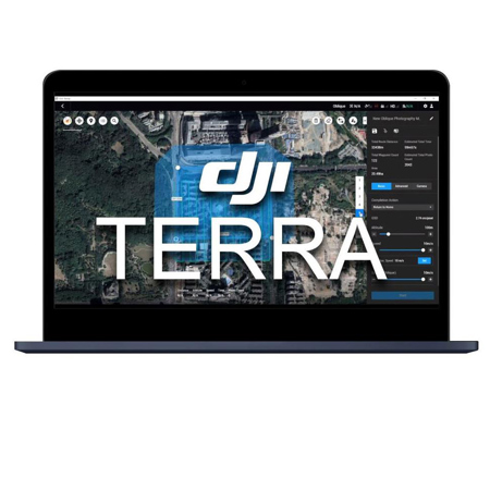
About DJI Terra
Make the World Your Digital Asset
DJI Terra is a PC application software that mainly relies on 2D orthophotos and 3D model reconstruction, with functions such as 2D multispectral reconstruction, LiDAR point cloud processing, and detailed inspection missions. It is a one-stop solution that delivers unparalleled efficiency to industry users, with comprehensive reconstruction models catering to verticals such as land mapping, power transmission, emergency services, construction and transportation.
Area Mapping
3D Models
Imports images captured from multiple angles, to auto-generate a realistic 3D model. Three resolutions available-high, medium and low-for image reconstruction in diverse scenarios, such as surveying and mapping, accident sites, power grid equipment, and progress-tracking for construction projects.
• 400 photos/1GB (single computer) Scale
• 30,000 photos/3 days (single computer) Efficiency
• 1111111 Accuracy Centimeter-level accuracy
2D Maps
Generate high resolution orthomosaics, enabling you to get detailed and accurate measurement results for all your critical projects.
• 400 photos/1GB (single computer) Scale
• 5,000 photos/2 hours (single computer) Efficiency
• 11111111 Accuracy Centimeter-level accuracy
LiDAR
Process point cloud data captured by the Zenmuse L1 in DJI Terra. In just one click, calculate POS data, fuse point cloud and visible light data, export point clouds in standardized formats, and generate fieldwork reports.
Multispectral
Using multispectral data from P4 Multispectral, generate radiometrically calibrated reflectance maps for remote sensing research and more, or produce vegetation index maps including NDVI and NDRE. Create prescription maps for variable rate application using DJI's Agras drones to improve crop yields while driving down costs.
More highlights
Real-time 3D Mapping
When efficiency is key, quickly render and visualize a 3D model of the mapped area. Make decisions based on the preliminary model and check for completeness immediately or plan 3D flights on-site.
Real-time Mapping
Quickly generate a 2D orthomosaic of the selected area in real-time. Not only is this ideal for creating detailed flight paths in remote areas but it's also useful for time-sensitive missions that require quick decision-making on site.
Detailed Inspection Mission Planning
Automatically generate waypoints and flight routes based on one or more points selected in a local 3D model or point cloud (or a third-party point cloud). A simulated camera view including the selected point is displayed onscreen to enable better waypoint selection and more efficient flight route planning, automating inspection workflows.
Seamless Workflows, Accurate Results
Unparalleled efficiency and user experience
A simple and intuitive interface that gets you flying in no time.
Run reconstruction missions by employing multiple graphics cards simultaneously to improve efficiency.
Meet and exceed your project standards
Incorporate POS data, GCPs, or both sets of data to create georeferenced maps and models with enhanced accuracy directly in the target coordinate system required by the project.
Convert the coordinates of your maps and models into 8500+ major coordinate systems by simply selecting the output that fits your needs.
View a quality report of your mission to ensure the results meet your accuracy standards.
With Region of Interest, image reconstruction can be performed to specific target region. In turn, this saves processing time and improves efficiency, while generating a clearer model or point cloud.
Intuitive and Effortless
Acquire key dimensions across an array of terrains with easy-to-use analysis tools that enable you to obtain a variety of measurement data based on linear, area and volumetric measurements.
Edit labels of measurements on existing models, which can be used for reporting and improving communication throughout ongoing projects.
Mission Planning
Waypoints Mission Planning
Create efficient flight paths using predefined waypoint actions and adjustable parameters like altitude, speed, gimbal pitch angle, aircraft heading and more. For more complex and tight missions that require high attention to detail, use 3D Flight Visualization to design and simulate tasks on existing 3D models.
Area Mission Planning
With just a few taps on the screen, you can automate complex missions, allowing you to seamlessly capture imagery which can be processed to produce a variety of maps and models for further analysis, and to aid decision-making.
Oblique Mission Planning
When accuracy is essential and details are vital to your critical operations, Oblique lets you capture a rich 3D model data set by adjusting the angle of the camera at a tilted angle, giving you an extra crisp view of the asset.
Corridor Mission Planning
Create automated flight missions around roads and railways by simply drawing a line on the map. Adjust mission settings to change the total area mapped, giving you the flexibility to choose between creating high-definition 2D maps and 3D models or quick overviews.
Digitize the World Around You
Surveying and Mapping
A groundbreaking aerial survey solution that takes automation and data utilization to a whole new level, delivering unparalleled cost benefits and efficiency to mapping professionals.
Transforming the Power Industry
The refined modeling of power cables, poles, transmission towers, and other infrastructure revamps automated inspections and galvanizes the digital transformation of electrical grids.
Public Safety
DJI Terra facilitates customers in the public safety sector in make scientific decisions with advanced 3D situational awareness and by harnessing key on-site information.
Revolutionizing Oil and Gas
DJI Terra plays a crucial role in site management, pipeline inspection, and prospecting operations, by improving productivity while reducing business costs, bringing unprecedented change to the technology of the energy industry.
DJI Terra Features
- Model reconstruction: Import images to generate a high-resolution 2D orthophoto map and a high-accuracy 3D model
- Real-time reconstruction: Generate a 2D orthophoto map and a 3D model in real time during the flight to output results as you fly
- Lidar data processing: Working with DJI L1, DJI Terra can generate high-accuracy true-color cloud points with one click
- Detailed Inspection: Automatically generate routes based on target points marked in a 3D model or point cloud to automate inspection workflows
- Model application: Easily measure targets, coordinates, distances, areas, volumes, and other key data and rename or export the data results