Share:
Trending
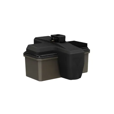
GeoCue TrueView 641 LiDAR Payload with LP360 Drone Software
SKU: GCFTV1002209 MFR: FTV1002209A00T
Earn VIP Reward PointsKey Features
- Capture precise LiDAR data with up to 6 returns, essential for detailed mapping projects.
- Experience superior accuracy with the TrueNav positioning system for reliable drone performance.
- Integrate seamlessly with LP360 Drone Software for efficient data processing and analysis.
- Utilize the 26 MP Global Shutter Camera for high-resolution imagery alongside LiDAR scans.
- Operate confidently in diverse environments with a robust 14°F to 122°F temperature range.
- Achieve exceptional scanner performance with precision <= 3mm and accuracy <= 4mm.
Temporarily On Backorder?Expected Availability: 05/2026
Free Shipping
See Options
1

Need help? Ask our experts.
Overview
Compare
Specs
Protection
About GeoCue TrueView 641
The TrueView 641 brings engineering-grade accuracy and long-range performance into a more accessible package, expanding NDAA-compliant options for surveyors, engineers, and mapping professionals. Developed in partnership with Triple-IN Laser Technic, this innovative aerial LiDAR system combines European engineering expertise with GeoCue's proven integration, software, and customer support.
Lightweight, reliable, and designed for real-world workflows, the TrueView 641 is the new standard for affordable, NDAA-compliant engineering-grade LiDAR.
Featured applications
• Rail Inspection
• Wire Extraction - Distribution
• Road Design
Support
• 1 year of hardware and software support
• 2 days of included training at our Huntsville, AL office
LP360 Drone
Drone LiDAR and photo processing workflow made simple
Use LP360 Drone for
• Intuitive workflow
• Multi-flight import and processing
• GIS interface allowing combination with other geospatial data
• Powerful point cloud visualization with multiple and synchronized windows
LP360 Photo
We have integrated directly into our drone mapping processing software, LP360 Drone, a Photo engine to produce fast backdrop orthophotos for your LiDAR project.
LP360 Photo is the LP360 Drone add-on for Ortho mapping:
• Rapidly create your orthophoto backdrop in a completely integrated workflow
• Efficient fast processing leveraging the LiDAR data with the photos?
LP360 Photo additional features:
• Export photo package to your 3rd party Photogrammetry software
• Support most common 3rd party sensors (DJI Mavic 3E, DJI Phantom 4 RTK and DJI Zenmuse P1)
LP360 Strip Align
Data can exhibit small geometric inconsistence, especially when combining data from multiple flights. Strip Align for LP360 Drone detects and corrects these errors via an application of sensor-specific mathematical modeling. Strip Align is a fully automated process with no need for users to set project-specific "tuning" parameters or to move in and out of the LP360 Drone processing environment - press a button and it works!
LP360 3D Accuracy
Automated horizontal and vertical checks remove the need for manual interaction
Use 3D Accuracy for:
• Automatically transform your check point coordinates into you project coordinates including datum and epoch
• "Autotarget" - Automatically find a 3D target on a drone dataset
• Calculation of correction for any 3D target
• Seamless workflow to apply the correction on the point cloud
• Use with ground control equipment
Drone Platforms
Our TrueView 3D Imaging Sensors were designed as a lightweight payload to allow flexible integrations on numerous drone platforms. We have worked with several drone providers to provide customers the complete drone mapping solution they are looking for. Don't see the company you're looking for, contact our team and we can discuss custom integrations!
GeoCue TrueView 641 Features
- Engineering-Grade, NDAA-Compliant LiDAR: Delivers long-range, high-accuracy aerial LiDAR performance in a lightweight, affordable, NDAA-compliant system
- Integrated LP360 Processing Workflow: Seamless LiDAR and photo processing with intuitive multi-flight handling, GIS integration, and advanced point-cloud visualization
- Versatile Application Support: Optimized for rail inspection, wire extraction, road design, and other engineering and mapping workflows
Warranty Information
This product has a limited warranty of 12 months.