


+3
more
more
See Options
Need help? Ask our experts.
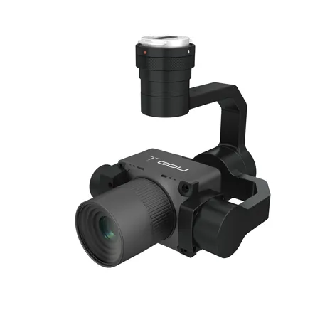
The TZS-S02 is a professional full-frame orthophoto camera designed for high-efficiency aerial mapping. It features a 61MP full-frame image sensor with 3.76 microm pixel size, paired with a dedicated 40mm photogrammetry lens (customizable to 56 mm).
The camera integrates with a 3-axis stabilized gimbal, providing sharp, distortion-free images even in dynamic flight conditions. With a minimum capture interval of 1 second, it enables fast, large-area coverage. Beyond orthophotos, it also supports close-range photogrammetry for creating detailed 3D models.
Its built-in 512GB storage capacity ensures sufficient space for high-resolution data collection, while TimeSync 2.0 synchronization technology ensures microsecond-level alignment between the camera, gimbal, flight control, and RTK, enabling precise mapping without ground control points. The lightweight yet durable CNC aluminum housing enhances portability and thermal management, making it ideal for terrain mapping, emergency response, natural resource surveys, and geological hazard investigations.
Designed for use with: S400 Series Drone .