


See Options
Need help? Ask our experts.
After exploring the great outdoors, you'll appreciate the advanced features of the Rino 750 2-Way Radio/GPS Touchscreen Handheld Navigator with Sensors. This rugged handheld device combines the power of GPS and GLONASS satellite reception, ensuring accurate tracking and positioning even in challenging terrains like deep canyons, dense forests, or remote locations.
The Rino 750 is more than just a navigator; it's also a powerful communication tool. It features a 5W GMRS two-way radio, allowing you to maintain voice or text communication with your fellow adventurers. The unique position reporting capability enables you to share your exact location with other Rino users, enhancing safety and coordination during your outdoor activities.
This handheld navigator is equipped with a barometric altimeter and a 3-axis compass, providing you with essential data to navigate effectively. It supports advanced mapping capabilities, including BirdsEye Satellite Imagery, and comes with a worldwide shaded-relief basemap. You can easily expand its mapping capabilities using the microSD card slot to load additional topographic, marine, or road maps.
The Rino 750 also keeps you informed about the weather. It supports Active Weather forecasts and animated radar tracking, providing real-time conditions, forecasts, and alerts directly on your handheld display when paired with a compatible smartphone and the Garmin Connect Mobile app. A built-in NOAA weather radio displays National Weather Service warnings and watches on the map screen, giving you a vital edge in weather awareness.
Wireless connectivity features enhance your experience with the Rino 750. Sync it with a compatible Bluetooth-enabled headset to improve radio communications, or pair it with a smartphone to receive smart notifications. You can customize your device's display with free apps, widgets, and data fields from the Connect IQ online store.
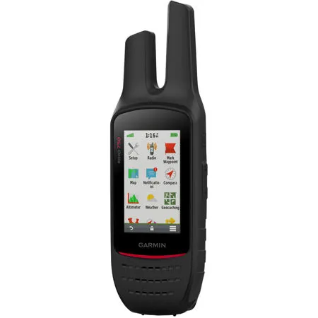
Designed to withstand the elements, the Rino 750 is durable and water-rated to IPX7. It features a vivid, dual-orientation, 3" color touchscreen that's glove-friendly and easy to read in bright sunlight. A dual battery system allows you to use either the included rechargeable lithium-ion power pack or an AA battery pack.
With the Garmin BaseStation software, you can turn your laptop into a field command center for tracking multiple Rino units. This feature allows for more effective search and rescue operations, even in areas without internet or cell phone service. Experience the confidence and convenience of the Rino 750 2-Way Radio/GPS Touchscreen Handheld Navigator with Sensors on your next outdoor adventure.