Drone Software
Save 5% Every Day† with the Adorama Edge Card. Learn More
Which brand would you like?
Drone Software

DroneSense Advanced Geospatial Features Software, Download
SKU: DSGEOMFR: DSGEO
Download Version
- Advanced geospatial software for DroneSense.
- Enhance drone operations with GPS tracking tech.
- Maximize flight stability with DroneSense software.
- Seamless software compatibility with DroneSense.
- Download provides easy access to drone features.
+ wishlist
Ways to Save

DroneSense Open API Access for Custom Integration
SKU: DSINTOPENAPIMFR: DSINT-OPENAPI
Download Version
- Unlock DroneSense API for custom drone integration.
- Enhance drone flight stability with advanced API access.
- Optimize drone image quality via seamless software control.
- Extend drone range using DroneSense Open API features.
- Simplify drone operations with user-friendly API access.
+ wishlist
Ways to Save

DJI Terra Standard 3D Modeling and Mapping Software, Perpetual License, Online
SKU: DJICPRJ22401MFR: CP.RJ.00000224.01
Download Version
- Streamline drone flight planning efficiently.
- Accurate 3D modeling for precise data analysis.
- Intuitive interface ensures ease of use.
- Advanced mapping capabilities, real-time tracking.
- Enhanced safety features for reliable operation.
DJI Terra Flagship 3D Modeling and Mapping Software, 1 Year Subscription, Online
SKU: DJICPRJ23501MFR: CP.RJ.00000235.01
Download Version
- Precise 3D modeling for accurate data capturing.
- Streamlined flight planning for drone operations.
- Real-time mapping delivers instant visual data.
- Automated features enhance mapping workflows.
- Advanced post-processing optimizes aerial imagery.

DroneSense Class 2 UAS Software License for DJI Matrice & Autel Max 4T/N Drones
SKU: DSC2MFR: DSC2
- Enhance drone operations with DroneSense software.
- Real-time data processing for informed decisions.
- Achieve mapping accuracy with advanced UAS software.
- Ensure flight stability using DroneSense Class 2.
- Seamless compatibility with DJI Matrice series.
Ships from Manufacturer
?
+ wishlist
Ways to Save

Wingtra Operating System + Apps Updates and Support Renewal, 1-Year
SKU: WGWROSAPPSREMFR: WR-OS-APPS-RENEWAL-1Y
- Seamless Drone Software Integration.
- Boost Automation with intuitive flight plans.
- Ensure Data accuracy with updated Wingtra OS.
- Real-time Data processing for critical insights.
- Optimize Cost-effective drone operations.
Special Order
?
Free Shipping
DroneSense Mobile Streaming and Tracking (MSAT) Software, Download
SKU: DSDSMSATMFR: DSMSAT
- Real-time tracking for optimal drone operations.
- Simplify flight planning with intuitive software.
- Advanced data analysis for actionable insights.
- High-precision mapping capabilities included.
- Ensure drone safety with robust features.
Special Order
?
Free Shipping

DroneSense Screen Share Only Software for DJI Avata, GoPro and Non-SDK Drones
SKU: DSSSOMFR: DSSSO
Download Version
- Enhance drone operations with DroneSense software.
- Experience real-time data & advanced tracking features.
- Enjoy ease of use & stable flight control software.
- Ensure data security with DroneSense screen sharing.
- Utilize offline maps for remote drone deployments.
+ wishlist
Ways to Save

Skydio Connect 5G Range Extender X10 to Dock, T-Mobile
SKU: SKYDR4SWRNGMFR: DR4SWRNGEXTDTNA
- Seamless Skydio X10 drone integration, T-Mobile.
- Extend range with 5G connectivity for Skydio drones.
- Real-time data streaming via T-Mobile network access.
- Enhanced flight stability with Skydio Connect extender.
- Automated flight control using Skydio software.
Special Order
?
+ wishlist
Ways to Save

DroneSense CloudStream for Dock
SKU: DSCSDMFR: DSCSD
Download Version
- Seamless drone data processing for quick insights.
- Real-time analysis ensures optimal flight stability.
- Enhance mapping accuracy with DroneSense CloudStream.
- Compatible with Nightingale & Fotokite drone docks.
- Easy-to-use interface for efficient drone operations.
+ wishlist
Ways to Save
Wingtra Bentley ContextCapture License, 30 Days
SKU: WGBENCC30DFMFR: BEN-CC-30DAY-FREE
- Optimize drone imagery with ContextCapture software.
- Process drone data fast with advanced 3D modeling.
- 30-day license: Bentley ContextCapture for Wingtra drones.
- Enhance drone mapping with high-resolution outputs.
- Advanced drone software: Streamline photogrammetry workflows.
Special Order Item
?
+ wishlist
Ways to Save
Dronetag Scout Yearly Cloud License for Additional Sensor
SKU: DTSCTADDLCNSMFR: DT-SCOUT-ADD-LICENSE
- Seamless Drone Flight Planning via cloud.
- Advanced Data Analysis for precision flights.
- Comprehensive Mapping Capabilities included.
- Real-time viewing for enhanced control.
- Robust Security features protect your data.
Special Order
?
Free Shipping

DroneSense Class 2 UAS Add-On DFR with DroneSense Remote for DJI Matrice Drones
SKU: DSC2DSRMFR: DSC2DSR
Download Version
- Enhance DJI Drones with DroneSense software.
- Real-time feedback improves drone mapping accuracy.
- Streamline data processing for efficient UAS missions.
- First Responder add-on ensures flight stability.
- Seamless compatibility with Matrice 30/300/350 drones.
+ wishlist
Ways to Save

DJI Terra Flagship 3D Modeling and Mapping Software, Perpetual License, Online
SKU: DJICPRJ22501MFR: CP.RJ.00000225.01
Download Version
- Advanced flight planning for drone mapping.
- Streamlined data analysis of drone imagery.
- Robust 3D modeling and mapping software.
- Real-time drone feedback for optimal flights.
- Perpetual license for enduring drone use.
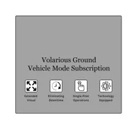
Volarious Ground Vehicle Mode Subscription for V-Line Pro M30
SKU: VLINEPROVMFR: VEHICLEMODE
- Enhance drone flight stability with Volarious software.
- Capture superior image quality using advanced algorithms.
- Experience ease of use with intuitive drone controls.
- Optimize battery life for extended drone operations.
- Unlock smart features for automated drone missions.
Special Order
?
Free Shipping
+ wishlist
Ways to Save
DroneSense Class N UAS Add-On DFR w/DroneSense Remote for DJI Mavic Mini 2 and 3
SKU: DSCNDSRMFR: DSCNDSR
Download Version
- Enhance DJI drone flights with DroneSense software.
- Real-time streaming for informed first responder UAS.
- Achieve superior flight stability with DroneSense Remote.
- GPS tracking ensures precise drone navigation control.
- Extend battery life with optimized DroneSense software.
+ wishlist
Ways to Save

Wingtra Pilot Perpetual License for WingtraOne Gen II BLU Drone, 3 Year
SKU: WGWIPBLUPLMFR: WIP-BLU-PL
- Wingtra Pilot: Seamless drone flight control.
- 3-Year License: Reliable drone software access.
- Gen II BLU Drone: Optimized GPS accuracy.
- Perpetual License: Invest in intelligent flight.
- Enhanced flight stability for smooth aerial views.
Special Order Item
?
+ wishlist
Ways to Save
DJI FlightHub Pro Software for Managing Select Drones (1-Year), Download
SKU: DJIFLGHTHBPRMFR: CP.HY.00000101.01
Download Version
- Manage up to 20 drones with DJI FlightHub Pro.
- Enhance drone data processing with advanced tools.
- Ensure mapping accuracy for professional drone use.
- Real-time data transmission for informed decisions.
- Offers compatibility with Matrice & Inspire drones.
Download Version
+ wishlist
Ways to Save

Skydio 3D Scan w/Maintenance & Support for Skydio X2E Drone, 5 Year Subscription
SKU: SKY3DSSW110MFR: SKY3DSSW110NA
Download Version
- Enhance Skydio X2E drone flights with 3D Scan.
- 5-year subscription ensures continuous software updates.
- Maximize image quality with advanced 3D modeling tools.
- Achieve superior flight stability via precise scans.
- Enjoy ease of use with streamlined Skydio software.
+ wishlist
Ways to Save
Wingtra Post-Processing Kinematic Dongle Set
SKU: WGPPKDONGLEMFR: PPK-DONGLE
- Precise drone data with post-processing kinematic.
- Enhance flight stability using advanced Wingtra software.
- Streamline workflows with user-friendly drone software.
- Maximize image quality via PPK correction algorithms.
- Process drone data efficiently with included USB dongles.
Special Order Item
?
+ wishlist
Ways to Save

SkyeBrowse Situational Awareness Package, Annual License
SKU: SBSITAWAREPKMFR: SB002
Download Version
- Real-time analysis for rapid situational awareness.
- Automated flight paths simplify data collection tasks.
- Process data quickly with SkyeBrowse software package.
- Ensure flight stability with advanced drone software.
- User-friendly interface for ease of use and training.
+ wishlist
Ways to Save

Skydio 3D Scan w/Maintenance & Support for Skydio X2E Drone, 1 Year Subscription
SKU: SKY3DSSW101MFR: SKY3DSSW101NA
Download Version
- Enhance Skydio X2E Drone capabilities with 3D Scan.
- Ensure data security with advanced Skydio software.
- Experience mapping accuracy for detailed inspections.
- Real-time data processing for immediate insights.
- Enjoy ease of use with intuitive Skydio software.
+ wishlist
Ways to Save
Skydio Data Storage Application for X10 Drone, 1 Year Subscription
SKU: SKYSWCLSTDR4MFR: SWCLSTDR4
- Secure Skydio X10 drone data storage for 1 year.
- Real-time data access with Skydio data application.
- Advanced tracking & flight stability via software.
- 512GB storage ensures comprehensive data security.
- Seamless compatibility with your Skydio X10 drone.
Ships from Manufacturer
?
+ wishlist
Ways to Save

DroneSense Airspace Awareness ADSB Exchange Flight Traffic Integration, Download
SKU: DSINTADSBXMFR: DSINT-ADSBX
Download Version
- Enhance drone flights with ADSB Exchange integration.
- Real-time data improves airspace awareness software.
- Automated flight logs ensure comprehensive data security.
- Mapping accuracy with DroneSense flight traffic display.
- Achieve flight stability using ADSB Exchange data.
+ wishlist
Ways to Save
Phoenix LiDAR CALIBRATION 1 - Includes calibration of LiDAR and single Camera
SKU: PHLSVCCAL1MFR: SVC.CAL1
- LiDAR calibration software ensures peak accuracy.
- Optimize LiDAR data with user-friendly software tools.
- Enhance image quality via precise camera calibration.
- Achieve flight stability with calibrated LiDAR system.
- GPS accuracy improved through software calibration.
Free Shipping