Drone Software
Save 5% Every Day† with the Adorama Edge Card. Learn More
Drone Software
Pix4D Pix4Dfields Software, 1 Device, Yearly License, Download
SKU: P4DFILDSYRMFR: FIELDS-YEAR
Download Version
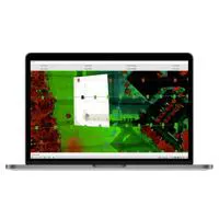
- Enhance drone imagery with Pix4Dfields software.
- Process drone data quickly with desktop application.
- Analyze aerial maps with intelligent flight modes.
- Yearly license offers real-time tracking & analysis.
- Achieve flight stability with advanced Pix4D tech.
Download Version

Pix4D PIX4Dmapper Drone Mapping Software, One-Time Charge, Download
SKU: P4DMAPPEROTCMFR: MAPPER-OTC-V2
Download Version
(2)- PIX4Dmapper: Professional drone mapping software.
- Perpetual license, one-time charge purchase.
- Robust 64-bit Windows OS compatibility.
- Reliable Brand: Advanced photogrammetry solution.
- Download delivery for fast software access.
Download Version

Pix4D Pix4Dmapper Support & Upgrade, 1 Year Extension, Before Expiry, Download
SKU: P4DSUPUPGMFR: MAPPER-SUP-UPG
- Enhance drone mapping with Pix4Dmapper software.
- Process drone imagery with advanced photogrammetry.
- Optimize drone data using Pix4D's robust algorithms.
- Ensure flight stability with precise data processing.
- Extend Pix4D software support for one year easily.
Special Order
?
Free Shipping
Skydio Patrol-Led DFR Plan with Cellular Data Plan for Skydio X10 Drone
SKU: SKYDR4PLDFG5MFR: DR4PLDFRCR5G
- Skydio X10 Drone compatibility ensures reliability.
- Seamless patrol-led DFR for rapid deployment.
- Advanced cellular data plan for connectivity.
- Benefit from Skydio's latest technology.
- Streamlined operations with Skydio DFR Plan.
Special Order
?
+ wishlist
Ways to Save

Pix4D PIX4Dmatic Support & Upgrade, 1 Year Extension, Before Expiry, Download
SKU: P4DMATICOTCSMFR: MATIC-OTC-SUP-UPG
- Precise data accuracy for professional mapping.
- Efficient flight planning optimizes drone operations.
- Streamlined post-processing workflow for rapid data.
- Enjoy 1-year of extended drone software support.
- Seamless compatibility with Windows & macOS systems.
Special Order
?
Free Shipping

AirData Enterprise with Livestream and Asset Management Starter Pack
SKU: ADAADENTCMFR: AD-ENT C
- AirData Enterprise: Streamline drone data analysis.
- Enhance flight stability with AirData's advanced tools.
- Real-time streaming for immediate aerial insights.
- GPS tracking ensures accurate drone location data.
- Manage drone assets efficiently with AirData software.
Ships from Manufacturer
?
Free Shipping

DroneSense Class 1 UAS Add-On DFR with DroneSense Remote for DJI Mavic 3 Drone
SKU: DSC1DSRMFR: DSC1DSR
Download Version
- Enhance DJI Mavic 3 with DroneSense software.
- First Responder software ensures flight stability.
- Maximize image quality with DroneSense integration.
- GPS tracking enabled for precise drone navigation.
- Experience intelligent flight modes via DroneSense.
+ wishlist
Ways to Save

Pix4D PIX4Dfields Agriculture Mapping Software, One-Time Charge, Download
SKU: P4DFIELDSOTCMFR: FIELDS-OTC-V2
Download Version
- Efficient drone software for accurate agriculture mapping.
- Seamless integration for streamlined workflow. Enhance data accuracy.
- User-friendly drone software. Boost efficiency now.
- Real-time analytics for informed agricultural decisions.
- Secure agriculture mapping with robust drone software.
Download Version

Skydio Connect 5G Range Extender, T-Mobile, 1 Year Per Quantity, Maximum 5 Year
SKU: SKYDR4SWRNGEMFR: DR4SWRNGEXTWPSNA
Download Version
- Enhance Skydio X10 drone range with 5G connectivity.
- Reliable T-Mobile network for seamless drone operation.
- Extend drone flight distance with the Connect 5G extender.
- Ensure stable Skydio drone control via 5G network.
- One-year Skydio Connect 5G range extender subscription.
+ wishlist
Ways to Save

DJI Terra Flagship 3D Modeling and Mapping Software, 1 Year Subscription, Online
SKU: DJICPRJ23501MFR: CP.RJ.00000235.01
Download Version
- Precise 3D modeling for accurate data capturing.
- Streamlined flight planning for drone operations.
- Real-time mapping delivers instant visual data.
- Automated features enhance mapping workflows.
- Advanced post-processing optimizes aerial imagery.
Phoenix LiDAR PC Master Suite Software, 1-Year Subscription, Download
SKU: PHLPCMS1YMFR: 600169
- Enhance drone data with Phoenix LiDAR software.
- Process LiDAR data easily with intuitive workflows.
- Access GCP support & custom coordinate systems.
- Optimize drone flights using intelligent software.
- Ensure flight stability with advanced algorithms.
Special Order
?
+ wishlist
Ways to Save

Dronetag Unlimited Data Scanning Hours 1-Year Subscription Plan for RIDER
SKU: DTRIDERLCNC1MFR: DT-RIDER-LICENCE-1YEAR-UN
Download Version
- Unlock drone detection with Dronetag LTE.
- 1-Year Unlimited Data Scanning for RIDER.
- Unrestricted, nonstop performance. 12 mos.
- Full Dronetag Cloud visibility access.
- Enhance drone safety with new tech.

AirData Live Streaming Add-On 1-Year Subscription for Drone, 20-Device, Download
SKU: ADADLS20U100MFR: AD-LS-20U100H
Download Version
- 1-year AirData Live Streaming Subscription included
- Empowers 20 users with robust live streaming access
- Enhances productivity for your professional team
- Seamless integration with AirData Enterprise base
- Boosts workflow efficiency for critical operations
AirData Enterprise
SKU: ADAADENTMFR: AD-ENT
Download Version
- Enhance drone operations with AirData Enterprise.
- Real-time data analysis improves flight stability.
- Autonomous flight planning ensures mission success.
- Seamlessly process images with advanced software.
- AirData software offers user-friendly interface.

SkyeBrowse Dual Pilot Software, Annual License
SKU: SBDPILOTMFR: SBDP001
Download Version
- Enhance drone operations with SkyeBrowse software.
- Dual Pilot license ensures mapping accuracy annually.
- Real-time data processing for informed decisions now.
- Experience automated flight, simplified data security.
- Achieve flight stability with user-friendly software.
+ wishlist
Ways to Save

Pix4D PIX4Dmatic Pro Drone Mapping Software, One-Time Charge, Download
SKU: P4DMATICPROOMFR: MATIC-PRO-OTC
Download Version
- Attain precise Data Accuracy in drone mapping.
- Streamlined automation for efficient drone workflows.
- Effortless Ease of Use with intuitive interface.
- Real-time Analytics enhance operational decisions.
- Seamless Integration with existing systems.
Download Version

Phoenix LiDAR Spatial Explorer Perpetual
SKU: PHLSFTPCEXPPMFR: SFT.PC.EXP.P
Download Version
- LiDAR software ensures flight stability analysis.
- Process LiDAR data with ease of use interface.
- Analyze high-quality images with LiDAR software.
- Maximize drone range with optimized LiDAR data.
- Intelligent flight planning via LiDAR software.

DJI Terra Standard w/Modify Flagship 3D Modeling & Mapping Software, 1-Yr,Online
SKU: DJICPRJ24701MFR: CP.RJ.00000247.01
- Accurate 3D mapping with Terra Standard software.
- Efficient data processing for aerial intelligence.
- Real-time analytics for informed decision-making.
- Customizable mapping for diverse drone tasks.
- Seamless compatibility with DJI drone platforms.
New Item
?
Free Shipping

Skydio Data Management and Streaming Suite for Utilities, 1 Year Subscription
SKU: SKYSWSUITMSUMFR: SWSUITEDMSU
- Enhance drone data security with secure Skydio software.
- Utilize real-time data streaming for informed decisions.
- Achieve mapping accuracy with advanced Skydio algorithms.
- Enjoy automated flight planning for efficient operations.
- Experience ease of use with intuitive Skydio interface.
Special Order
?
+ wishlist
Ways to Save

SkyeBrowse Situational Awareness Package, Annual License
SKU: SBSITAWAREPKMFR: SB002
Download Version
- Real-time analysis for rapid situational awareness.
- Automated flight paths simplify data collection tasks.
- Process data quickly with SkyeBrowse software package.
- Ensure flight stability with advanced drone software.
- User-friendly interface for ease of use and training.
+ wishlist
Ways to Save

Pix4D PIX4Dmatic Standard Drone Mapping Software, One-Time Charge, Download
SKU: P4DMATICSTANMFR: MATIC-STANDARD-OTC
Download Version
- Efficient drone software for accurate mapping tasks.
- User-friendly drone software, ease of use prioritized.
- Superior mapping accuracy for professional projects.
- Robust data security protects your aerial imagery.
- Seamless integration for diverse drone operations.
Download Version

DJI FlightHub 2 Storage Space Upgrade Package
SKU: DJIFH2SSUPMFR: CP.RJ.00000104.01
- Enhance DJI FlightHub 2 with 500GB storage.
- Optimize drone software with expanded storage space.
- Ensure DJI FlightHub 2 compatibility, seamless use.
- Boost flight data storage for improved analysis.
- Upgrade drone software for enhanced data capacity.
Special Order
?
Free Shipping

Skydio X10 Dock 1 Year Plan with Cellular Data
SKU: SKYDR4DOKPLNMFR: DR4DOKPLN5G
- Seamless Flight Planning & execution, streamlined.
- Real-time monitoring: Drone data accuracy ensured.
- User-friendly interface: Maximize ease of use.
- Precision mapping capabilities enhanced control.
- Reliable cellular data for constant connection.
Special Order
?
+ wishlist
Ways to Save
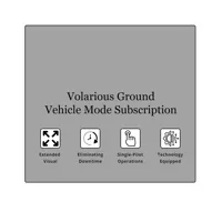
Volarious Ground Vehicle Mode Subscription for V-Line Pro M30
SKU: VLINEPROVMFR: VEHICLEMODE
- Enhance drone flight stability with Volarious software.
- Capture superior image quality using advanced algorithms.
- Experience ease of use with intuitive drone controls.
- Optimize battery life for extended drone operations.
- Unlock smart features for automated drone missions.
Special Order
?
Free Shipping