Used Drone Software
Save 5% Every Day† with the Adorama Edge Card. Learn More
Drone Software

Used Strand Lighting 100 Plus Series 12/24 Portable Rack Mountable Console
SKU: VDXPSL61318MFR: VDXPSL61318
Condition:Excellent
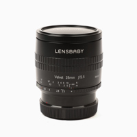
Used Lensbaby Velvet 28 28mm f/2.5 Lens for Canon RF, Black
SKU: EOL2825LBVBMFR: LBV28CRF
Condition:Well Used
- High-quality, all-metal, hand-crafted 28mm f/2.5 art lens for Canon RF
- Exceptional 1:2 macro capabilities with a close focus distance of 2 inches
- Designed for landscape, adventure, travel, and street photography
- Offers Lensbaby's popular variable glow effects at a wide 28mm focal length
- Creates unique in-camera creative effects for an ethereal mood and depth in imagery
Free Shipping

Used REOLINK 12MP Security Camera System RLK16-1200B8-A
SKU: VDCREK161200MFR: VDCREK161200
Condition:Mint
Free Shipping

Used Philips Strand Lighting Propack 12 Channel Rack Mount Dimmer
SKU: VDXPP75332MFR: VDXPP75332
Condition:Average

Used DRAGONFRAME 3 Stop Motion Animation USB Keypad (Software CD Not Included)
SKU: CUXDRAGFRA3MMFR: CUXDRAGFRA3M
Condition:Excellent Plus
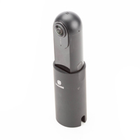
Used Insta360 Insta360 ONE Action Camera 360 7K Photo 4K Video for iPhone6/7 Series
SKU: VDCINSTA3601
(2)Condition:Average
Free Shipping
Used Vinpower Digital Titan Supreme SATA DVD/CD Automated Duplicator (8-Target, 1000-Disc Capacity)
SKU: CUXSUP1000SBMFR: CUXSUP1000SB
Condition:Open Box
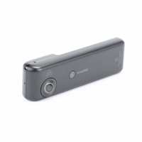
Used Insta360 Nano S Spherical 360deg. Video Camera for iPhone X, iPhone8/8 plus, iPhone 7/7 plus, iPhone 6s/6s plus - Black
SKU: VDCINSTNSBMFR: 211626
(1)Condition:Excellent
- 4K 360 degree video
- 360 degree video call and multi-view function
- 360 degree live streaming onto Facebook/YouTube/twitter
- supports free capture function
Free Shipping
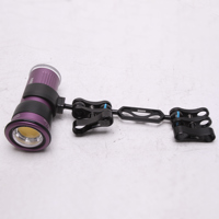
Used Keldan 4X 10K Lumen Underwater Video Light
SKU: VDXKLD4XUWLMFR: VDXKLD4XUWL
Condition:Average
Free Shipping

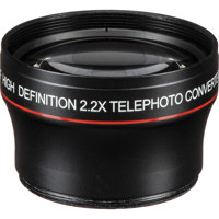
Used Canon Wide Converter Lens 0.8x-IIA W80-IIA with 85II Adapter
SKU: VDLCWCW80IIAMFR: VDLCWCW80IIA
Condition:Well Used
Free Shipping
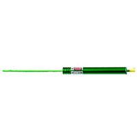
Used Safariland Laser Bullet Trajectory Pointer, Green
SKU: VDXSABP2
Condition:Open Box
- Laser Trajectory Pointer: Accurate analysis tool.
- Enhance firearm analysis with green laser beam.
- Durable construction ensures reliable performance.
- Simple to use for effective trajectory analysis.
- Compliant with safety standards; Safariland quality.
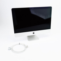
Used Apple 21.5" iMac 3.1GHz Intel Core i7 Quad-Core, 8GB RAM, 1TB HDD, 512MB NVIDIA Geforce GT 650M Graphics (Late 2012)
SKU: VDXACIMA1418
Condition:Average
Free Shipping
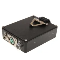
Used GKC Research & Development Model 300 Communications Amplifier Phone Dialer
SKU: AUXGKC300440MFR: AUXGKC300440
Condition:Well Used
Used Lenovo Tab K11 TB330FU 11" WUXGA 64GB Wi-Fi Tablet, MediaTek MT6769H Helio G88 2.0GHz, 4GB RAM, Android 13, Luna Gray
SKU: CUTLEZADC000MFR: ZADC0002US
Condition:Excellent
- Vivid 11" WUXGA display for clear viewing.
- Efficient MediaTek G88 processor for tablets.
- Generous 64GB storage, expandable for files.
- Seamless Android 13 OS, optimized experience.
- Long-lasting 7040mAh battery for portability.

Used NVIDIA GeForce GTX 970 4GB GDDR5 PCI Express 3.0 Graphics Card
SKU: CUXNVGTX970CMFR: CUXNVGTX970C
Condition:Excellent
Free Shipping
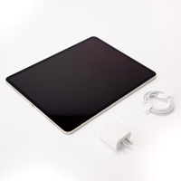
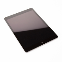
Used Apple iPad Air 13" with M3 Chip, Early 2025 Starlight 512GB Wi-Fi
SKU: CUTACMCNX4LLMFR: MCNX4LL/A
Condition:Heavy Use
- Liquid Retina display features technologies like P3 wide color, True Tone & ultralow reflectivity
- Apple Intelligence that helps you write, express yourself, and get things done effortlessly
- M3 is a powerful chip built for Apple Intelligence and brings amazing performance
- iPadOS makes iPad more productive, intuitive, and versatile
- Apple Pencil Pro transforms iPad Air into an immersive drawing canvas
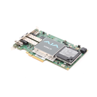
Used AJA KONA IP 8-Lane PCIe 2.0 Video & Audio Desktop I/O Card
SKU: CUXAJKIPR0S2MFR: KONA-IP-R0-S02
Condition:Excellent Plus
- Supports 4K/UltraHD video formats for superior quality.
- PCIe 2.0 ensures high-speed video and audio processing.
- HDMI output delivers pristine digital video clarity.
- Up to 16-channel embedded audio for professional sound.
- SMPTE ST 2110 IP video input/output for broadcast.
Free Shipping
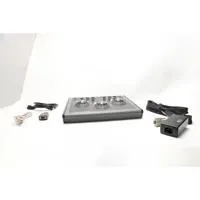
Used JLCooper Eclipse SX Midnight Compact Color Controller
SKU: VDXJLCECSXMNMFR: VDXJLCECSXMN
Condition:Well Used
Free Shipping
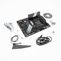
Used ASUS ROG Crosshair VIII Hero Wi-Fi AMD X570 ATX Gaming Motherboard
SKU: CUDAS90MB10TMFR: 90MB10T0-M0AAY0
(6)Condition:Excellent
- AMD AM4 socket
- Comprehensive thermal design
- Robust power delivery
- High-performance networking
- 5-Way Optimization
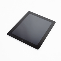
Used Apple iPad 10.2", 128GB, Wi-Fi + Cellular, 8th Gen 2020, iPadOS 14, Space Gray
SKU: CUTACMYN72LLMFR: MYN72LL/A
(33)Condition:For Parts
- 10.2" Retina display for incredible detail and vivid colors
- All-day battery life to keep you going
- Built-in 8MP back camera and front FaceTime HD camera
- A12 Bionic chip for editing 4K video, playing graphics-intensive games, and experiencing AR apps