


+2
more
more
See Options
Need help? Ask our experts.
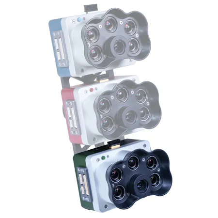
Precision superspectral imaging supporting agronomy and ecology, from seedling to harvest.
High-resolution multispectral drone sensors for plant classification, weed identification, environmental research and conservation, and digital plant phenotyping.
• Perform detailed analysis on carotenes and Anthocyanins by using indices like PRI, ARI & CRI
• Obtain imagery comparable to Landsat and Sentinel satellite data at an enhanced resolution
• Perform detailed analysis on chlorophyll efficiency and identify weeds
• Conduct reliable time-series analysis even in varying light conditions
• Enable accurate crop counting in early growth stages using machine learning and Al
• Generate insights beyond what the eye can see with multiple outputs and indices such as RGB, NDVI, NDRE, OSAVI, PSRI and DSM
• Work with the equipment you already have - compatible with most professional drone platforms such as DJI and Pix4D
• With a total of 4 bands in the rededge spectrum, more biophysical parameters can be distinguished
Applications
Crop Health Analysis
Monitor chlorophyll levels, detect stress early, and evaluate crop health to optimize treatment.
Advanced Pigment Detection
Track Carotenoid and Flavonoid content to optimize flavor and crop maturity.
Species Identification
Differentiate crops from weeds, identify invasive species, and enable targeted field management.
Ecosystem Resource Surveillance
Track vegetation changes, soil conditions, and water availability for sustainable land conservation.
Coastal Habitat Mapping
Map near-shore ecosystems, detect algae blooms and aquatic vegetation across tidal zones and wetlands.
Designed for use with: RC Aircraft .