This item is no longer available.
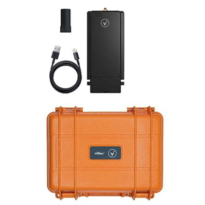
The viDoc RTK rover is a device that can be mounted onto Apple iPhone 13 Pro Max. The rover, synchronized with PIX4Dcatch, geotags images with RTK accuracy in real-time, while connected to any NTRIP service, allowing absolute accuracy in 3D photogrammetric scanning.
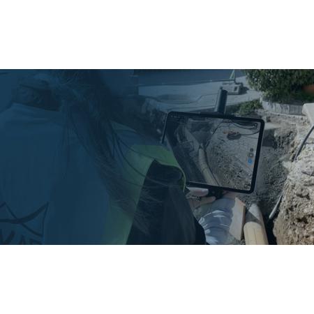
Use a handheld RTK rover to elevate single point measurement with 3D scans
Multiple options for accurate point measurement
Measure with the laser, photogrammetry, or attach it to a surveying rod.
Measure obstructed points
Complete data collection without missing anything that may be obstructed by objects like trees or overhangs.
Accurate and safe measurement methods
Get your measurements and reduce risks - cut unnecessary trench visits, etc. Make data collection safer.
The viDoc RTK rover with PIX4Dcatch: Accurate surveying with a mobile device
Easy field-to-finish workflows
Easy digitalization with Pix4D software that can measure single points or create line work from data capture.
RTK positioning rover for 3D scanning
viDoc RTK rover pairs with the PIX4Dcatch to geotag images of the 3D scan in real-time using NTRIP services
Enhanced mobile data collection
viDoc connects to over 600 channels (including all major constellations such as GPS, GLONASS, Galileo, etc.) which results in convergence in under 5 seconds.
Replacing complex workflows
Ground surveying equipment like laser scanners can be expensive, bulky, and highly technical. Drones can be restricted by regulations. Overcome the obstacles with a handheld rover.
A complete, accurate workflow in your hands
The viDoc, the iOS device, PIX4Dcatch, and PIX4Dcloud. An end-to-end solution that gets measurements with an absolute accuracy of less than 5cm.
Intuitive feel and structure
Easy for anyone to collect points or complete an accurate 3D scan. The handheld rover combines with mobile software to create digital twins as fast as possible.