

This item is no longer available.
Transform your work with precise 3D scans and AR
What makes PIX4Dcatch the best solution?
Georeferenced 3D scanning
PIX4Dcatch can create detailed and georeferenced 3D models using both photogrammetry and LiDAR technology from your smartphone.
Versatile processing options
Flexible solutions for processing, including direct upload to PIX4Dcloud for easy processing and/or export to PIX4Dmatic for advanced control.
RTK compatibility
Achieve absolute centimeter accuracy in your 3D models with PIX4Dcatch and RTK.
Innovative AR features
Use AR to easily detect GCPs and see as-built and CAD design overlays for construction analysis.
Ease of use
Intuitive UI with comprehensive support makes it easy for all users to quickly master.
Workflow
Capture ground data
Walk along or around the area of interest to scan, and PIX4Dcatch will automatically record video frames with positional and orientation information.
Ensure completeness
Experience real-time AR feedback on your scan's coverage and completion with a 3D mesh overlay and point cloud live viewer.
Pause and restart
Pause the capture whenever needed. The live viewer continues to display on your device, displaying the areas you've already covered.
Export and process
Upload the captured images to PIX4Dcloud or export them to PIX4Dmapper or PIX4Dmatic to generate accurate, measurable, and easy to share 3D models and point clouds.
Learn how PIX4Dcatch can be the right fit for you
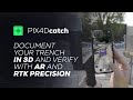
Utilities and subsurface mapping
• Quick trench scans for documentation of subsurface utilities
• Visualization in AR, even after closure
• Save time and cut costs
Construction verification and earthworks
• Overlay DXF, IFC, or SHP designs
• Measure and compare volumes
• Reduce costs, speed up project timelines
Civil engineering and site verification
• Overlay CAD files for real-site comparison
• Cloud uploads for collaborative work
• Speed up reviews, keep projects on track
Forensics scene capture
• Merge drone and phone data for 3D models
• Secure, offline, user-friendly workflow
• Detailed and comprehensive scene documentation
Land surveying
• Streamline surveying with user-friendly interface
• Integrate with PIX4Dmatic and PIX4Dcloud
• Easy data processing and report sharing
Professional
The Professional license includes all the offerings of the Standard license, but with an additional range of premium features, including:
• RTK connection capability
• Automatic GCPs and tie points detection with Pix4D Autotags
• Augmented reality features: AR Points, Display projects in AR (requires PIX4Dcloud subscription)
Features
Capture
General: Capture Screen
• Automatically capture images and save them with their precise geolocations
• Pause and resume capture
• Save or abort capture
• Live preview during the capture
• Display mesh during the capture
• Quality report at the end of the capture
Settings
Capture Settings
• Customize the image overlap or the device pose
• Warning sound messages
• Auto focus
• Skip low quality images
View
• Display image overlap while capturing
• Display camera views
• Display feature points
Mesh
• Display reconstruction mesh
• Save mesh (OBJ format)
• Change the mesh type and color
• Change mesh and camera objects color
Other
Save video
Projects
Projects Dashboard
• List of projects
• Filter project by status
• Search projects
• Select and delete multiple projects
• Refresh the project panel by dragging down
Project View
3d View
• Display a 3D view of the captured point cloud
• Enable different tags for RTK, GPS, GCPs or MTPs
• RTK accuracy per image classified into three levels: Optimal , Reduced , or Low
• Customize your view by toggling RTK accuracy, cameras, point clouds, meshes, and 3D model centering
• Compute the texture
• Show a 3D view of the processed point cloud from PIX4Dcloud
Images
• List of images
• Select and delete multiple images
Details
• Date of creation
• Image coordinate reference system
• Number of images
• Geolocation source
• RTK accuracy confidence percentage
• Horizontal and vertical average accuracy
• Used storage
Option
• Rename projects
• Delete projects
Project Tools
Manual GCP Marking
• Select a point collection
• Add marks on images
• Save the marks
Volume Computation
• Densification of the point cloud
• Define the volume base by drawing points in the area of interest
• Automatic volume computation
• Cut and filled volumes displayed: values, shapes and accuracy
• PDF export of the results
Capture Tools
Point Management: Measure Point
• Create a point collection with a defined CRS (planimetry and altimetry)
• Create a site localization coordinate reference system
• Import points with a defined CRS (planimetry and altimetry)
• View points on a map
• Rename points
• Enter the antenna height when using a GNSS pole
• Add a reference photo (optional)
• Add a description (optional)
• Change the measurement duration
Tag Detection
• Use tie point with the auto tag detection workflow and get their true coordinates afterwards
• Import a point collection and use GCPs for the project with the auto tag detection workflow
• Optimization of tag detection after the capture
AR points
Display points in augmented reality with an RTK device connected
AR Settings
• Turn on or off the lines displayed between the points
• Turn on or off the point labels
Pix4Dcloud AR
Pix4Dcloud Project List
• List of PIX4Dcloud projects
• Filter project by type (sites or datasets)
• Order project by name or by date
• Search projects
AR Display
• Adjust the opacity of the AR project with the slider
• Display PIX4Dcloud layers and see their properties
• Display PIX4Dcloud projects with Autotags in AR (including indoor)
RTK Connection
• RTK accuracy indicator (if not connected to RTK, GPS strength indicator is displayed)
• Connection to an RTK device compatible with PIX4Dcatch (Emlid Reach RX, Trimble Catalyst DA2, BadElf, Leica FLX100, viDoc)
• Easy camera offsets setting when using a case, either SPC or SPC+, and using correct rover handle
• Manual camera offsets
• Enter of the NTRIP credentials
• Selection of the mountpoint
Export
Project
• Export all data (ZIP file) for a single project or for multiple projects
• Export points and marks for GCPs
• Export captured point cloud (PLY file)
• Export captured mesh (OBJ file)
• Export logs
Point
• Export measured point (ZIP file)
• Export site localization coordinate system (WKT file)
• Export Autotags tie points coordinates with their accuracies
Upload to PIX4Dcloud
General
• Upload one or several projects
• Upload project to an organization
• Upload project to an already existing site or create a new one
• Upload project to an already existing folder or create a new one
Processing Options
• Process with Gaussian Splatting technique
• Compute a DSM model of the area
• Compute an orthophoto of the area
• Process with GCPs and/or MTPs
• Select the output coordinate reference system (projected or a site localization)