


See Options
Need help? Ask our experts.
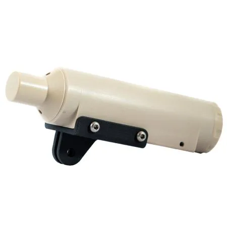
Be at the forefront of underwater exploration with the U-QPS Underwater Quick Positioning System. This innovative system, developed by the reputable brand Qysea, is a comprehensive software and hardware ecosystem that offers a real-time 3D map of your FIFISH ROV's location. It's more than just a positioning system; it's a tool that enhances your underwater photography and videography experience, bringing professional-level precision to your discovery missions and inspection tasks.
The U-QPS system is designed to withstand various underwater interferences, ensuring reliable performance in diverse aquatic environments. It provides a real-time display of your ROV's position, direction, depth, distance, altitude, and trajectory, giving you complete control and awareness of your device's movements.
With the U-QPS, you can set Point-of-Interest (POI) locations at any time, allowing you to mark and return to specific underwater sites with ease. The system also enables you to track and record the ROV's movement path, combining various mapping software to display and track the path of movement. This feature is particularly useful for documenting your underwater explorations or for conducting detailed inspections.
The U-QPS Underwater Quick Positioning System is not just a tool, but a companion for your underwater adventures. Its compact and stylish design, coupled with its high-quality construction, ensures durability and ease of use in even the most challenging underwater conditions. Experience the difference with the U-QPS system and elevate your underwater photography and videography to new depths.
