senseFly Duet T Thermal Mapping Camera with eBee X Series Integration Kit
SKU: SF050027
This item is no longer available.
Share:
Overview
Compare
Specs
Protection
About senseFly Duet T
2 sensors, 1 heat map star
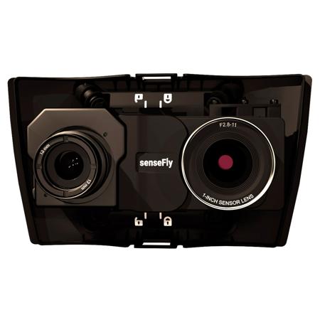
The senseFly Duet T is a rugged dual RGB/thermal mapping camera rig. Use it to create geo-accurate thermal maps and digital surface models quickly and easily.
RGB
The Duet T thermal mapping camera includes a high-resolution thermal infrared (640 x 512 px) camera and a senseFly S.O.D.A. RGB camera.
Thermal
Both RGB and thermal image sources can be accessed as and when required, while the rig's built-in Camera Position Synchronisation feature works in sync with Pix4Dmapper photogrammetry software (optional) to simplify the map reconstruction process.
Results
In this urban example, an RGB map of a residential zone (left) is merged into a thermal orthomosaic (right). The latter was generated using data from a senseFly Duet T thermal mapping camera.
The Integration Kit to install the senseFLY Duet T camera on eBee X Drone.
senseFly Duet T Features
- 2 sensors, 1 heat map star
- Compatible with eBee X Drone