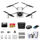
Picture does not represent the actual item
See what's in the box
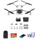
Picture does not represent the actual item
See what's in the box
This item is no longer available.
Smarter Farming Package
End to End solution for precision agriculture
• Maximize yields and minimize costs with drone technology
• Optimize Inputs: Seed / Nitrogen / Water
• Estimate Crop Yields: Precisely calculate field characteristics
• React Quicker to Threats: Weeds / Pests / Fungi
• Save Time Crop Scouting: Validate treatment / Actions taken
• Improve Variable Rate Prescriptions: Real-time aerial information
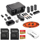
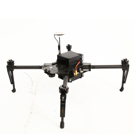
Package includes DJI Matrice 100, two types of sensors, travel case, 4x TB48D batteries and professional software from PrecisionHawk.
Matrice 100
Stable, reliable, and easy-to-fly, the Matrice 100 is an ideal aerial data collection tool for the field.
• Long flight time: Up to 40 minutes with 2 x TB48D batteries
• Remote control distance: Up to 5 KM
• Precise positioning: GNSS module compatible with GPS and GLONASS
• Customization: Supports multiple cameras and DJI SDK
• High portability: Small and light, easy to transport and operate
Sensors
Visual Sensor
Ideal for:
• Plant counting / spacing
• 3D drainage mapping
• Plant height / biomass measurements
• Canopy coverage density
Multispectral Sensor
Ideal for:
• Plant health monitoring
• Invasive weed mapping
• Anomaly detection
• Weather damage assessment
Accessories
• Professional travel case
• 4x TB48D batteries
Software
• Precision Hawk DataMapper: One year of DataMapper Standard subscription is included in the Smarter Farming Package. It includes 2D and 3D map processing, 11 crop analytics tools and 150 GB of storage.
• DataMapper InField: The InField desktop application lets you immediately view drone captured data in the field, see flight path coverage and add ground control points with a few simple clicks. It is compatible with any drone and provides an intuitive user interface.
• DataMapper InFlight: InFlight is a full-fledge Android app that will aid autonomous agricultural surveys using DJI quadcopters. By enabling your Android device to act as the Ground Control Station (GCS), the need for another device to operate the quadcopter is eliminated.
• Plan flights, track your quad and monitor its health
• Get information delivered in real time
• Perform emergency actions such as Emergency Land or Return to Home
• Works offline in the field. InFlight works without an internet connection if a flight plan has already been created
• Compatible with Matrice, Phantom series and Inspire 1