
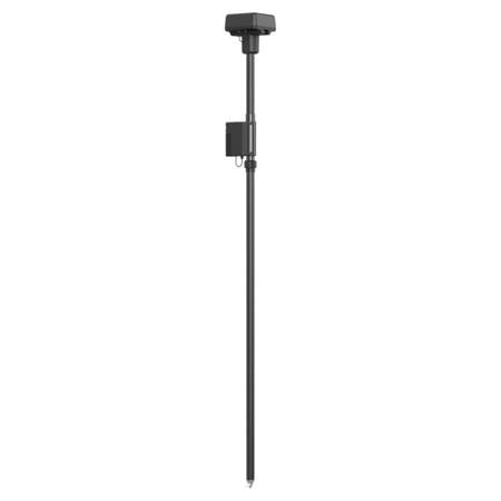
Picture does not represent the actual item
See Options
Need help? Ask our experts.
Review Summary
Simultaneously receive
GPS: L1 C/A, L2, L5
Beidou: B1, B2, B3
GLONASS: F1, F2
GALILEO: E1, E5A, E5B
Single Point
Horizontal:1.5 m(RMS)
Vertical:3.0 m(RMS)
RTK
Horizontal: 0.4" / 1 cm+ 1 ppm (RMS)
Vertical: 0.8" / 2 cm+ 1 ppm (RMS)
1 ppm: For every 0.62 mi / 1 km increase in distance the accuracy will be 0.04" / 1 mm less.
For example, the horizontal accuracy is 0.43" / 1.1 cm when the receiving end is 0.62 mi / 1 km away from the base station.
Update Rate: 1 Hz, 2 Hz, 5 Hz, 10 Hz, and 20 Hz
< 45 Seconds
< 10 seconds
< 1 Seconds
>99.9%
Data Format: RTCM 2.x/3.x
OcuSync, Wi-Fi, LAN, and 4G
2.400 GHz to 2.483 GHz (China, United States, Australia, Europe, Japan, Korea)
5.725 GHz to 5.850 GHz (China, United States, Australia)
OcuSync
2.4 GHz
SRRC (Mainland China) / CE (Europe) / MIC (Japan) / KCC (Korea): < 20 dBm
FCC (United States, Australia) / NCC (Taiwan, China): < 26 dBm
5.8 GHz
FCC (United States, Australia) / SRRC (Mainland China) / NCC (Taiwan, China): < 26 dBm
Wi-Fi
2.4 GHz
SRRC (Mainland China) / CE (Europe) / MIC (Japan) / KCC (Korea): < 20 dBm
FCC (United States, Australia) / NCC (Taiwan, China): < 22 dBm
5.8 GHz
FCC (United States, Australia) / SRRC (Mainland China) / NCC (Taiwan, China): < 22 dBm
Operating Mode 1/3
SRRC/NCC/FCC/MIC/KCC/CE: 2 km
(Unobstructed and free of interference, when the D-RTK 2 Mobile Station is used as a base station and the distance from the D-RTK 2 antenna to the bottom of the tripod is 1.8 m, when the difference in height between the remote controller and D-RTK 2 is less than 2 m, and when the remote controller is 1.2 m from ground level)
Operating Mode 4
Between the aircraft and mobile station:
NCC/FCC: 7 km; SRRC/MIC/KCC/CE: 5 km
Between the remote controller and mobile station: 200 m (Unobstructed and free of interference at a flying altitude of about 120 m, when the distance from the D-RTK 2 antenna to the bottom of the tripod is 1.8 m, and when the remote controller is 1.2 m from ground level)
Operating Mode 5
NCC/FCC: 12 km; SRRC/MIC/KCC/CE: 6 km
(Unobstructed and free of interference, when the distance from the D-RTK 2 antenna to the bottom of the tripod is 1.8 m)
16 GB
12 W
16.5 to 58.8VDC
Required, included
Lithium ion
1
Non-universal
4920 mAh
37.3 Wh
WB37 Battery: > 2 hours
MG-12000P Battery: > 50 hours
4 Degree to 131 Degree F (-20 Degree to 55 Degree C)
IP65
D-RTK 2 Body with Extension Rod: 6.6 x 6.6 x 67.2" (16.8 x 16.8 x 170.8cm)
Because precision and reliability are paramount in surveying and mapping applications, the D-RTK 2 High Precision GNSS Mobile Station from DJI is an advanced, high-tech solution designed to deliver unparalleled accuracy. This upgraded GNSS receiver supports all major global satellite navigation systems, including GPS, GLONASS, Beidou, and GALILEO, providing real-time differential corrections that yield centimeter-level positioning data for superior relative accuracy.
The D-RTK 2 Mobile Station is not just precise, but also quick and easy to set up. Its high-gain antenna ensures optimal signal reception from a multitude of satellites, even in the presence of obstructions, enhancing the accuracy of drone-based operations.
Designed for seamless connectivity, this high-precision GNSS mobile station supports multiple communication modes, including 4G, OcuSync, WiFi, and LAN. This ensures uninterrupted, stable data transmission under any application scenario. It can connect to up to five remote controllers simultaneously when used with DJI Agras drones, the Phantom 4 RTK, or the P4 Multispectral, and can even connect to multiple aircraft when used with the Matrice 300 RTK. This multi-drone connectivity opens up possibilities for coordinated operations, significantly boosting efficiency.
Durability is another key feature of the D-RTK 2 Mobile Station. With an IP65 level ingress protection and a lightweight carbon fiber body, this portable GNSS mobile station is built to withstand tough conditions. Its built-in IMUs monitor movements and calibrate the tilt sensors, alerting the operator of any abnormalities during the mission, thereby minimizing risks.
The D-RTK 2 Mobile Station is a comprehensive solution compatible with a range of DJI products including Phantom 4 RTK, P4 Multispectral, MG-1P RTK, Agras T16, Agras T20, Matrice 210 RTK V2, and Matrice 300 RTK. It also supports DPS (DJI Positioning Service), providing high precision positioning data within the cover range of the base station. This makes it an ideal tool for a variety of industrial applications, including surveying, aerial inspections, and agriculture.