

more

This item is no longer available.
Review Summary
2023-08-08T10:44:18
The Autel EVO Pro II V3 is an excellent flying machine and very good platform for shooting stills.
ROY I.
2023-03-16T22:57:46
Exactly what I was looking for! The signal is amazing no breakup!!! And the new smart controller is great!!
alexis p.
Extend coverage on pre-owned products after the retailer warranty ends and protect photo & video gear from accidental damage with Adorama Protect.
If we can’t fix it, we’ll replace it at no additional cost.
Coverage for pre-owned gear begins after the retailer warranty ends, plus accidental damage protection for photo/video gear that starts on day one.
Enjoy your gear without fear. We have you covered!
When regular use of your product over time results in mechanical or electrical failure.
We will never charge you a deductible after the purchase of a plan.
Our claims process is simple & easy and our customer service team is happy to help.
Adorama Protect powered by Extend is available for purchase to customers in the United States. Not available for International and U.S. territories purchases. Plans on pre-owned items do not cover pre-existing damages.
Browse our FAQ
397mm
4.34miles (7000m)
8 m/s (Ludicrous)
4 m/s (Ludicrous)
20m/s (Ludicrous)
21km
120 Degree /s
33 Degree (Ludicrous)
36min
32min
14 Degree F - 104 Degree F (-10 Degree C - 40 Degree C)
Level 8
902-928MHz (FCC Only)
2.400-2.4835GHz
5.725-5.850GHz (non-Japan)
5.650-5.755GHz (Japan Only)
900M
FCC/ ISED:<=31dBm
2.4G
FCC/ ISED:<=32dBm
SRRC/CE/MIC/RCM:<=20dBm
5.8G (non-Japan) ; 5.7G (Japan)
FCC/ISED/SRRC/MIC:<=33dBm
CE/ RCM:<=14dBm
When RTK is enabled and working normally:
Vertical: +/-0.1 m; Horizontal: +/-0.1 m
Vertical: +/-0.1 m (when the visual positioning is working normally);
+/-0.5 m (when GPS works normally)
Horizontal: +/-0.3 m (when the visual positioning is working normally);
+/-1.5 m (when GPS works normally)
The position of the camera center relative to the phase center of the airborne A-RTK antenna, under the body axis system: (-2.63, 0.31, 83.5) mm, and the photo EXIF coordinates have been compensated. The positive XYZ axis of the body axis system points to the front, right, and bottom of the aircraft respectively.
8GB
Max. support 256GB (UHS-3 or Class 10)
Required, included
Lithium ion
Non-universal
3
Folded: 9.05 x 5.11 x 5.62" (230 x 130 x 143mm)
Unfolded: 17.99 x 21.96 x 5.62" (457 x 558 x 143mm)
With propeller and battery: 2.72 lbs (1.23kg) ( +/-0.5g)
GPS+BeiDou+Galileo (Asia)
GPS+GLONASS+Galileo (Other areas)
High-Precision RTK GNSS:
Frequency points used:
GPS:L1/L2;
GLONASS:L1/L2;
BeiDou:B1/B2;
Galileo:E1/E5
First positioning time: <50 s
Positioning accuracy:
vertical 1.5 cm + 1 ppm (RMS);
Horizontal 1 cm + 1 ppm (RMS)
1 ppm means that the error increases by 1 mm for every 1 km the aircraft moves
3-axis stabilization
Tilt: -135 Degree to +45 Degree ;
Pan: -100 Degree to +100 Degree
Tilt: -90 Degree to +30 Degree ;
Pan: -90 Degree to +90 Degree
300 Degree /s
+/-0.005 Degree
Omnidirectional sensing system
Accurate measurement range: 0.5-18 m
Effective sensing speed: <12m/s
Viewing angle: Horizontal: 60 Degree , Vertical: 80 Degree
Accurate measurement range: 0.5-16 m
Effective sensing speed: <12m/s
Viewing angle: Horizontal: 60 Degree , Vertical: 80 Degree
Accurate measurement range: 0.5-10 m
Effective sensing speed: <5m/s
Viewing angle: Horizontal: 65 Degree , Vertical: 50 Degree
Accurate measurement range: 0.5-10 m
Effective sensing speed: <5m/s
Viewing angle: horizontal: 100 Degree , vertical: 80 Degree
Accurate measurement range: 0.5-10 m
Effective sensing speed: <5m/s
Viewing angle: horizontal: 65 Degree , vertical: 50 Degree
Forward, Backward and Sides:
Surface with clear pattern and adequate lighting (lux > 15)
Upward:
Detects diffuse reflective surfaces (>20%) (walls, trees, people, etc.)
Downward:
Surface with clear pattern and adequate lighting (lux > 15)
Detects diffuse reflective surfaces (>20%) (walls, trees, people, etc.)
1" CMOS; 20M pixels
FOV: 82 Degree
35 mm format equivalent focal length: 29 mm
Aperture: f/2.8 - f/11
Focus range: 0.5 m to infinity
Video: 100-44000
Photos: 100-6400
Photo mode: 1/8000 - 8s
Other: 1/8000 - 1/frame rates
1-16x (up to 3x lossless zoom)
Single shot/Burst shooting/AEB/Time Lapse/HDR
5472 x 3648 (3:2)
5472 x 3076 (16:9)
3840 x 2160 (16:9)
JPG (default) / DNG / JPG+DNG
5472 x 3076P30/P25/P24
3840 x 2160P60/P50/P48/P30/P25/P24
2720 x 1528P60/P50/P48/P30/P25/P24
1920 x 1080P60/P50/P48/P30/P25/P24
MP4 / MOV (MPEG-4 AVC/H.264, HEVC/H.265)
120Mbps
FAT32/exFAT
7100 mAh
11.55 V
LiPo 3S
82 Wh
14 Degree F to 104 Degree F (5 Degree C to 45 Degree C)
14-86 Degree F (-10-30 Degree C), 65 +/-20%RH
71.6-82.4 Degree F (22-28 Degree C)
93W
90 minutes
12.87 oz (365g)
100-240 V, 50/60 Hz, 1.5A
13.2 V - 5 A
5V - 3A, 9V - 2A, 12V - 1.5A
13.2 +/-0.1V
66W
13.2 V
14 Degree F to 104 Degree F (5 Degree C to 45 Degree C)
902-928 MHz (FCC only)
2.400-2.4835 GHz
5.725-5.850 GHz (non-Japan)
5.650-5.755 GHz (Japan only)
FCC: 15 km
CE: 8 km (Unobstructed, Free of Interference)
EVO II Pro V3
EVO II Dual 640T V3
EVO II RTK Series V3
EVO II Enterprise V3
2048x1536 60fps
2000 nits
5800 mAh
3 hours (Max. Brightness) (Approx.)
4.5 hours (50% Brightness) (Approx.)
90 minutes
ROM 128GB
-4 Degree F to 104 Degree F (-20 Degree C to 40 Degree C)
IP43
11.9 x 7.4 x 3.4" (303 x190 x87mm) (antennas folded)
11.9 x 10.7 x 3.4" (303 x273 x87mm) (antennas unfolded)
2.5 lbs (1.1kg) (without protective case)
2.7 lbs (1.2kg) (with protective case)
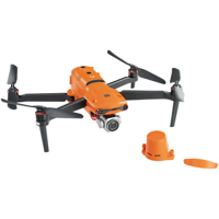
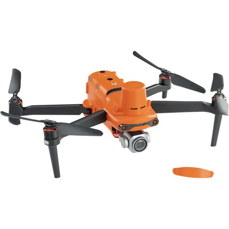
Why settle for less when you can have the best with the EVO II V3 Pro 6K RTK Rugged Drone Bundle This advanced, high-tech drone is designed for professionals and enthusiasts alike who demand superior image quality and robust performance.
The EVO II V3 Pro 6K RTK Rugged Drone features a state-of-the-art 6K gimbal camera, capable of capturing high-resolution images and videos with minimal distortion and noise. Its 1-inch 6K CMOS image sensor, updated for maximum performance, delivers up to 20 megapixels of detail. Even under twilight or night conditions, the drone's ultra-sensitive algorithm ensures clean, detailed, and low-noise data sets.
This rugged drone is optimized for software image correction, using a brand new image processing algorithm that makes thermal imaging details sharper and more discernible than similar resolution competitors. With a 30Hz refresh rate for videogrammetry, the EVO II RTK Dual provides accurate and detailed 3D thermal maps.
Zoom in on critical areas with the EVO II RTK's 16x digital zoom, which supports 4x lossless zoom. The drone also offers multiple color palettes for versatile imaging options.
The EVO II RTK Series V3 is upgraded with Autel's all-new SkyLink 2.0 Video Transmission technology, supporting tri-band communication and automatic frequency hopping for maximum anti-interference capability. Enjoy HD video transmission up to 15km and obtain critical details with QHD video within 1km.
Equipped with 19 groups of sensors, including 12 visual sensors, the main camera, ultrasound, IMUs, and other sensors, this drone can build three-dimensional maps and plan paths in real time. Its compact design folds up for easy transport and deployment, and it boasts a level 8 wind resistance for greater stability and control in all windy conditions.
The EVO II RTK Series V3 is compatible with Live Deck 2, offering multiport streaming to monitors and Wifi support for multiple smartphones. It also features a Smart Controller with a 2000nit super-bright screen, a 5800mAh Lithium-ion battery for up to 4.5 hours of continuous use, and a Qualcomm 8-core processor for smooth 4K/60fps video playback.
Whether you're into powerline inspection, photogrammetry, law enforcement, or firefighting, the EVO II V3 Pro 6K RTK Rugged Drone Bundle is the ultimate tool for aerial photography and videography.