
This item is no longer available.
Review Summary
Extend coverage on pre-owned products after the retailer warranty ends and protect photo & video gear from accidental damage with Adorama Protect.
If we can’t fix it, we’ll replace it at no additional cost.
Coverage for pre-owned gear begins after the retailer warranty ends, plus accidental damage protection for photo/video gear that starts on day one.
Enjoy your gear without fear. We have you covered!
When regular use of your product over time results in mechanical or electrical failure.
We will never charge you a deductible after the purchase of a plan.
Our claims process is simple & easy and our customer service team is happy to help.
Adorama Protect powered by Extend is available for purchase to customers in the United States. Not available for International and U.S. territories purchases. Plans on pre-owned items do not cover pre-existing damages.
Browse our FAQ
Maximum: 2.31 lbs (1.05kg)
Diagonal 14.96" (380.1mm)
6 m/s (Normal Mode)
8 m/s (Sport Mode)
6 m/s (Normal Mode)
6 m/s (Sport Mode)
(At sea level, no wind) 15 m/s (Normal Mode)
Flying forward: 21 m/s, flying sideways: 20 m/s, flying backwards: 19 m/s (Sport mode)
12 m/s
Above Sea Level: 6000m (without a payload)
43 minutes (without wind)
37 minutes (without wind)
32km
30 Degree (Normal Mode)
35 Degree (Sport Mode)
200 Degree /s
GPS + Galileo + BeiDou + GLONASS (GLONASS is supported only when RTK module is enabled)
Vertical: +/-0.1 m (Vision Positioning enabled); +/-0.5 m (GNSS Positioning enabled); +/-0.1 m (D-RTK enabled)
Horizontal: +/-0.3 m (Vision Positioning enabled); +/-0.5 m (HD Positioning enabled); +/-0.1 m (RTK enabled)
14 Degree to 104 Degree F (-10 Degree to 40 Degree C)
N/A
2008
9453F Enterprise Edition
Built-in module
Folded (without propellers): 8.77 x 3.79 x 4.81" (223 x 96.3 x 122.2mm)
Unfolded (without propellers): 13.68 x 11.14 x 5.49" (347.5 x 283 x 139.6mm)
With propellers and RTK module: 33.54 oz (951g)
4/3 CMOS
Effective Pixels: 20 MP
FOV: 84 Degree
Equivalent focal length: 24 mm
Aperture: f/2.8 to f/11
Focus: 1 m to Infinite
100-6400
Electronic shutter: 8-1/8000 s
Mechanical shutter: 8-1/2000 s
5280x3956
Single shot: 20 MP
Timelapse: 20 MP
JPEG: 0.7/1/2/3/5/7/10/15/20/30/60 s
JPEG + RAW: 3/5/7/10/15/20/30/60 s
Panorama: 20 MP (original material)
H.264:
4K: 3840 x2160@30fps
FHD: 1920 x1080@30fps
4K: 130Mbps
FHD: 70Mbps
exFAT
JPEG/DNG (RAW)
MP4 (MPEG-4 AVC/H.264)
1/2.8-inch CMOS, effective pixels: 5 MP
FOV: 73.91 Degree (61.2 Degree x 48.10 Degree )
Equivalent focal length: 25 mm
Aperture: f/2.0
Focus: Fixed Focus
Green (G): 560 +/- 16 nm
Red (R): 650 +/- 16 nm
Red Edge (RE): 730 +/- 16 nm
Near infrared (NIR): 860 +/- 26 nm;
1x-32x
Electronic Shutter: 1/30-1/12800 s
2592 x1944
TIFF
MP4 (MPEG-4 AVC/H.264)
Single shot: 5 MP
Timelapse: 5 MP
TIFF: 2/3/5/7/10/15/20/30/60 s
H.264
FHD: 1920 x 1080@30fps
Video content: NDVI/GNDVI/NDRE
Stream: 60 Mbps
3-axis mechanical gimbal (tilt, roll, pan)
Tilt: -135 Degree to 45 Degree
Roll: -45 Degree to 45 Degree
Pan: -27 Degree to 27 Degree
Tilt: -90 Degree to 35 Degree
Pan: Uncontrollable
100 Degree /s
+/-0.007 Degree
Omnidirectional binocular vision system, with an infrared sensor at the bottom of the aircraft
Distance Measuring Range: 0.5 m to 20 m
Detection Range: 0.5 m to 200 m
Effective Obstacle Avoidance Speed: Flight Speed <=15 m/s
FOV: Horizontal 90 Degree , vertical 103 Degree
Distance Measuring Range: 0.5 m to 16 m
Effective Obstacle Avoidance Speed: Flight speed <=12 m/s
FOV: Horizontal 90 Degree , vertical 103 Degree
Distance Measuring Range: 0.5 m to 25 m
Effective Obstacle Avoidance Speed: Flight speed <=15 m/s
FOV: Horizontal 90 Degree , vertical 85 Degree
Distance Measuring Range: 0.2 m to 10 m
Effective Obstacle Avoidance Speed: Flight Speed <=6 m/s
FOV: Front and rear 100 Degree , left and right 90 Degree
Distance Measuring Range: 0.3 m to 18 m
Effective Obstacle Avoidance Speed: Flight speed <=6 m/s
FOV: Front and rear 130 Degree , left and right 160 Degree
Front, Rear, Left, Right, Above: Surfaces with clear patterns and adequate lighting (> 15 lux, environments with normal indoor fluorescent light exposure)
Below: Surfaces with diffuse reflection material and a reflectivity of >20% (such as walls, trees, people, etc.); Adequate lighting (>15 lux, environments with normal indoor fluorescent light exposure)
DJI O3 Image Transmission Industry Edition
Remote Controller: 1080p/30fps
2.400-2.4835GHz
5.725-5.850GHz
(Unobstructed, No interference)
FCC: 15 km
CE: 8 km
SRRC: 8 km
MIC: 8 km
Strong Interference (urban landscapes, residential areas, etc.): 1.5-3 km (FCC/CE/SRRC/MIC)
Medium Interference (suburban landscapes, city parks, etc.): 3-9 km (FCC), 3-6 km (CE/SRRC/MIC)
Weak Interference (remote fields, open farmland, etc.): 9-15 km (FCC), 6-8 km (CE/SRRC/MIC)
15 MB/s (with DJI RC Pro Industry Edition)
Latency (depending on environment and mobile device)
Approximately 200 milliseconds
4 antennas, 2 transmitting and 4 receiving
2.4 GHz: <33 dBm (FCC), <20 dBm (CE/SRRC/MIC)
5.8 GHz: <33 dBm (FCC), <30 dBm (SRRC), <14 dBm (CE)
Supports the DJI Cellular module
Aircraft: Please use a memory card with a speed rating of V30 or higher, or use a memory card from the recommended list
Remote Controller:
SanDisk Extreme PRO 64GB V30 A2 microSDXC
SanDisk High Endurance 64GB V30 microSDXC
SanDisk Extreme 128GB V30 A2 microSDXC
SanDisk Extreme 256GB V30 A2 microSDXC
SanDisk Extreme 512GB V30 A2 microSDXC
Lexar 667x 64GB V30 A2 microSDXC
Lexar High-Endurance 64GB V30 microSDXC
Lexar High-Endurance 128GB V30 microSDXC
Lexar 667x 256GB V30 A2 microSDXC
Lexar 512GB V30 A2 microSDXC
Samsung EVO Plus 64GB V30 microSDXC
Samsung EVO Plus 128GB V30 microSDXC
Samsung EVO Plus 256GB V30 microSDXC
Samsung EVO Plus 512GB V30 microSDXC
Kingston Canvas Go! Plus 128GB V30 A2 microSDXC
Kingston Canvas React Plus 128GB V90 A1 microSDXC
Aircraft:
SanDisk Extreme 32GB V30 A1 microSDHC
Extreme PRO 32GB V30 A1 microSDHC
Extreme 512GB V30 A2 microSDXC
Lexar 1066x 64GB V30 A2 microSDXC
Kingston Canvas Go! Plus 64GB V30 A2 microSDXC
Kingston Canvas React Plus 64GB V90 A1 microSDXC
Kingston Canvas Go! Plus 128GB V30 A2 microSDXC
Kingston Canvas React Plus 128GB V90 A1 microSDXC
Kingston Canvas React Plus 256GB V90 A2 microSDXC
Samsung PRO Plus 256GB V30 A2 microSDXC
5000 mAh
15.4 V
17.6 V
LiPo 4S
Lithium Cobalt
77 watt-hours
41 Degree to 104 Degree F (5 Degree to 40 Degree C)
Required, included
Lithium Ion
Non universal
1
11.83 oz (335.5g)
100V to 240V (AC), 50Hz to 60Hz, 2.5A
100 Watts
Maximum output power of 100 Watts (total)
When both the ports are used, the maximum output power of one interface is 82 W, and the charger will dynamically allocate the output power of the two interfaces according to load power
USB-C: 5V to 20V, 5.0A
Battery Port: 12V to 17.6V, 8.0A
100 Watts
3 batteries on charging rotation
41 Degree to 104 Degree F (5 Degree to 40 Degree C)
USB-C
Approximately 1.2 watts
Fixed RTK:
Horizontal: 1 cm + 1 ppm; Vertical: 1.5 cm + 1 ppm
1.97 x 1.58 x 2.60" (50.2 x 40.2 x 66.2mm)
0.84 oz (24g) (+/-2g)
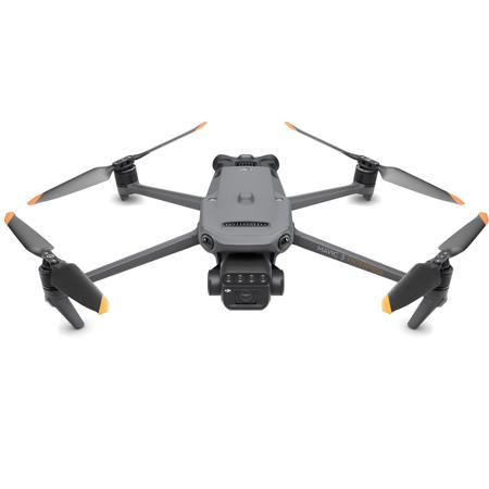
Discover the unparalleled capabilities of the Mavic 3M Multispectral Drone, a sophisticated tool designed for precision and clarity in aerial surveying. This state-of-the-art drone is equipped with an advanced imaging system that integrates a 20MP RGB camera with four 5MP multispectral cameras, capturing detailed data across the green, red, red edge, and near-infrared spectrums. The Mavic 3M is an essential asset for professionals in agricultural production management, offering high-precision aerial surveying, crop growth monitoring, and natural resource surveys.
The Mavic 3M's multispectral camera system includes:
- Near-infrared (NIR): 860 nm +/- 26 nm
- Red edge (RE): 730 nm +/- 16 nm
- Red (R): 650 nm +/- 16 nm
- Green (G): 560 nm +/- 16 nm
The RGB camera boasts impressive features:
- A 4/3 CMOS sensor capturing 20MP images
- The fastest mechanical shutter speed of 1/2000s
- A high-speed burst mode of 0.7s when utilizing the RGB camera
A built-in sunlight sensor enhances the Mavic 3M's capabilities by capturing solar irradiance, which is crucial for light compensation during 2D reconstruction. This feature ensures more accurate NDVI results and consistent data over time.
The Mavic 3M's RTK module provides centimeter-level positioning accuracy, syncing with the flight control and camera systems to precisely capture the location of each imaging center. This technology allows for high-precision aerial surveying without the need for ground control points, streamlining operations and saving valuable time.
With an ultra-long battery life of up to 43 minutes, the Mavic 3M can complete mapping operations over an area of 200 hectares in a single flight. The drone supports high-efficiency fast charging with a 100W Battery Charging Hub and 88W fast charging capability, ensuring minimal downtime and maximum productivity.
The Mavic 3M's O3 transmission technology ensures a stable signal and smooth image transmission over ultra-long distances of up to 15km. Omnidirectional obstacle sensing and terrain-follow aerial surveying are made possible by the drone's multiple wide-FOV vision sensors, providing accurate obstacle detection in all directions and facilitating surveying in challenging landscapes.
Applications of the Mavic 3M include:
- Orchard mapping with terrain-follow capabilities
- Generation of high-resolution orchard maps and 3D operation routes
- Variable rate applications for efficient crop management
- Intelligent field scouting with real-time data upload and AI analysis
- Environmental monitoring and natural resource surveys
The Mavic 3M also supports an open ecosystem with Cloud API connectivity, allowing for seamless integration with third-party cloud platforms without the need for separate app development. Additionally, the drone is compatible with Mobile SDK 5 (MSDK5), offering an open-source production code sample for custom app development tailored to specific UAV field patrol, smart surveying, and other scenarios.
Embrace the innovative technology of the Mavic 3M Multispectral Drone with RC Controller for your professional aerial surveying needs and experience the benefits of high-tech precision and advanced data analysis.