See Options
Need help? Ask our experts.
Review Summary
Black
USB 3.1 Gen2
1TB SSD
Industrial-grade Aluminum
1.5h
<30W
Supports Wi-Fi, Bluetooth: 802.11a/b/g/n/ac, 5G2 Wi-Fi 5180-5240MHz
2.4G Wi-Fi 2412-2472MHz
5G8 Wi-Fi 5745-5825MHz
China
7.09 x 5.12 x 15.7" (180 x 130 x 400mm)
3.75 lbs (1.7kg)
-4 Degree F - 122 Degree F (-20 Degree C-50 Degree C)
IP54
Supported
Supported
Supported
.las
.jpg
1.18" (3cm)
1.18" (3cm)
0.79" (2cm)
1.18" (3cm)
0.2" (0.5cm)
1.18" (3cm)
0.015 Degree
0.39" (1cm)
0.03 Degree
0.79" (2cm)
Supported
1.64-393.7' (0.5-120m)
320,000 points/s
Class 1/905nm
360 Degree x 270 Degree
2x 48MP
1/2"
2mm
Rolling shutter
f/2.0
190 Degree x 190 Degree
Max 56MP
1x 1MP
190 Degree x 119 Degree
Global shutter
14.4V
46.8wh
Required, included
Lithium ion
Non-universal
2
100V-240V
50-60 HZ 1.5A 80VA
34W
16.8V 2.0A
Supported Channels:
GPS L1/L2/L5
GLONASS L1/L2
BDS B1/B2/B3
Galileo E1/E5a/E5b/E6b
Accuracy:
Horizontal: 0.8cm+1 ppm
Vertical: 1.5cm+1 ppm
Antenna:
Impedance: 50 ohms
Polarization mode: right-handed circular polarization
Horizontal coverage angle: 360 Degree
Output standing wave: < 2.0
Maximum Gain: 2.8dBi
Supported channels:
GPS L1/L2/L5
GLONASS L1/L2
BDS B1/B2/B3
Galileo E1/E5a/E5b/E6bAccuracy:
Horizontal: 0.8cm + 1 ppm
Elevation: 1.5cm + 1 ppm
Antenna:
Impedance: 50 ohms
Polarization mode: right-handed circular polarization
Antenna axis ratio: < 3dB
Horizontal coverage angle: 360 Degree
Output standing wave: <2.0
Maximum Gain: 5.5dBi
Dimensions: 23.62 x 23.62 x 5.9" (60 x 60 x 15cm)
Weight: 5.5 lbs (2.5kg)
Supported
Supported
Supported
Metal
Horizon RMSE: 2.3" (6cm)
Vertical RMSE: 2.7" (7cm)
0.79" (2cm)
1.18" (3cm)
Applicable
Not Applicable
Not Applicable
Not Applicable
DJI UAV
RTK (RMS):
Horizon:1cm+1ppm
Vertical:1.5cm+1ppm
Recommended altitude: 98.4' (30m)
Maximum altitude: 164' (50m)
Recommended speed: 3m/s
Maximum speed: 5m/s
Without L2 Pro: 14.3 lbs (408g)
With L2 Pro: 4.8 lbs (2.2kg)
Within recommended speed and RTK disconnection distance less than 328.08' (100m)
Horizontal RMSE: 1.18" (3cm)
Vertical RMSE: 1.9" (5cm)
0.79" (2cm)
1.18" (3cm)
0.39" (1cm)
Up to 3 hours
Applicable
Not Applicable
Not Applicable
Not Applicable
Horizontal: 0.8cm + 1ppm
Vertical: 1.5cm + 1ppm
Recommended speed: 20-30km/h
Maximum speed: 40km/h
Mounting Bracket: 4.3 lbs (1.9kg)
Bracket + Battery: 5.6 lbs (2.5kg)
Bracket + Battery + L2 Pro: 9.7 lbs (4.4kg)
6978158970244
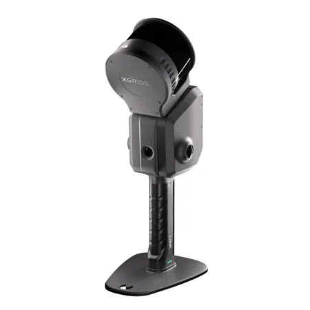
Real-time scanning and modeling device
The new Lixel L2 Pro combines LiDAR, visual, and IMU modules with AI, delivering real-time point cloud data that rivals post-processed quality, ushering in the "zero post-processing era" for SLAM devices.
Fully integrated and deeply optimized
Rotating LiDAR
Dual 48MP panoramic vision, no external cameras needed
High-precision 6DOF IMU
Multi-SLAM joint optimization, maximizing performance
True SLAM with real-time output
L2 Pro delivers real-time point cloud data that rivals the accuracy of L2's post-processing, with no waiting-instantly ready for use. The real-time coloring effect rivals post-processing quality.
The LixelUpSample algorithm: Generating photo-quality color point clouds
1 million points sq. m with 1mm spacing for dense point clouds, capturing every detail with precision. 5mm point cloud thickness for more accurate mapping and line drawing.
Reliable SLAM for complex environments
Exclusive Multi-SLAM algorithm enhances adaptability and reliability in challenging environments: Provides continuous absolute coordinates in satellite-signal-limited areas like indoors or underground. Ensures stable mapping in degraded environments such as subways and tunnels.
A seamless, user-friendly, and reliable workflow
Precision verification report
Direct phone connection
One-click GCP marking process
Maximize usability and flexibility
Extension pole
RTK
Phone mount
Supporting harness
Drone mount
Vehicle mount