


Photogrammetry Software
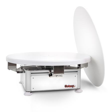
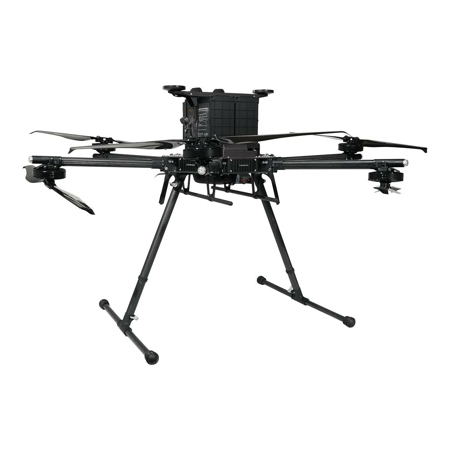
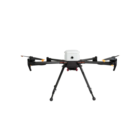
Photogrammetry software has rapidly evolved into an essential tool for professionals and enthusiasts seeking to transform ordinary photographs into detailed, accurate 3D models. Whether you’re a surveyor mapping vast landscapes, an architect visualizing future builds, a cultural heritage specialist preserving artifacts, or a creative in gaming or VFX, the right photogrammetry solution can dramatically streamline your workflow. These advanced applications process overlapping images—captured from the ground, drones, or even handheld cameras—by aligning, analyzing, and reconstructing them into digital point clouds, textured meshes, orthomosaics, and digital surface models. The winter months, with their unique lighting and atmospheric conditions, often inspire new photogrammetry projects, from capturing snow-laden cityscapes to documenting frost-covered archaeological sites. For those looking to start in this field, many software options offer intuitive interfaces and guided workflows, making it easy to experiment with 3D reconstructions using just a basic camera and a set of overlapping photos. As your skills progress, more advanced photogrammetry management software provides robust tools for precise measurement, batch processing, and integration with CAD or GIS platforms, supporting everything from topographic mapping to cinematic visual effects.
Choosing photogrammetry software involves considering both your technical needs and your creative ambitions. Beginners and hobbyists often appreciate free or open-source solutions that allow them to explore the fundamentals of 3D modeling without a steep learning curve. These platforms are perfect for students, educators, or anyone curious about digital reconstruction—making them thoughtful gifts for aspiring photographers, architecture students, or tech-savvy teens interested in STEM. Professionals in surveying, civil engineering, and construction gravitate toward feature-rich solutions that offer high-accuracy outputs, seamless integration with drone workflows, and support for large datasets. In these industries, photogrammetry management software becomes a cornerstone for planning, analysis, and documentation, especially when winter weather limits on-site visits and increases reliance on remote data collection. Artists and designers, meanwhile, use these tools to bring real-world textures and objects into virtual environments, enriching everything from video games to virtual reality experiences. No matter your background, investing in photogrammetry software opens up a world of creative and practical possibilities, allowing you to capture, preserve, and reimagine the world in three dimensions. For those building a comprehensive digital workflow, exploring complementary solutions like Photography Studio Software can further enhance productivity and creativity, ensuring your studio is equipped for every stage of the imaging process.
Choosing photogrammetry software involves considering both your technical needs and your creative ambitions. Beginners and hobbyists often appreciate free or open-source solutions that allow them to explore the fundamentals of 3D modeling without a steep learning curve. These platforms are perfect for students, educators, or anyone curious about digital reconstruction—making them thoughtful gifts for aspiring photographers, architecture students, or tech-savvy teens interested in STEM. Professionals in surveying, civil engineering, and construction gravitate toward feature-rich solutions that offer high-accuracy outputs, seamless integration with drone workflows, and support for large datasets. In these industries, photogrammetry management software becomes a cornerstone for planning, analysis, and documentation, especially when winter weather limits on-site visits and increases reliance on remote data collection. Artists and designers, meanwhile, use these tools to bring real-world textures and objects into virtual environments, enriching everything from video games to virtual reality experiences. No matter your background, investing in photogrammetry software opens up a world of creative and practical possibilities, allowing you to capture, preserve, and reimagine the world in three dimensions. For those building a comprehensive digital workflow, exploring complementary solutions like Photography Studio Software can further enhance productivity and creativity, ensuring your studio is equipped for every stage of the imaging process.


