+4
more
more

See Options
Need help? Ask our experts.
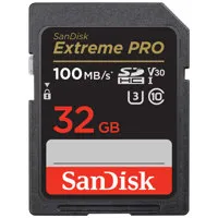
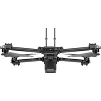
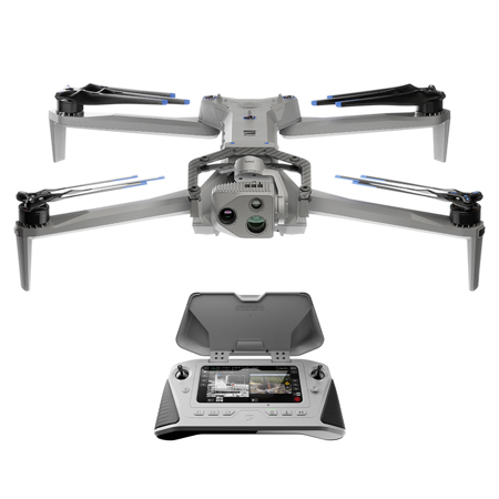
Before you explore the world of aerial photography and videography, consider the advanced X10 Drone with Cellular 5G, IR Navigation Camera, and VT300-L Sensor Package. This high-tech drone is powered by the most sophisticated AI in the sky, ensuring you capture the data you need, whenever and wherever you need it.
The X10 Drone is equipped with visionary cameras that pack more megapixels and superior optics than any drone of its size. Its modular sensor packages include high-resolution visual and radiometric cameras, enabling you to capture the right details for your job. This drone is the first to integrate a FLIR Boson+ sensor, delivering unrivaled thermal imaging with resolutions of 640 x 512 px and increased sensitivity.
The X10 Drone's custom-engineered lenses offer unrivaled resolution and superior focus, ensuring pixel-perfect images every time. Its powerful Spectra 480 image signal processor enhances white balance, de-noises photos, extends HDR capabilities, and more. The compact transition zoom system maintains superior image quality even in zoomed-in shots, while custom wide aperture lenses allow 1.7-3.5x more light than competitors for outstanding low-light images.
The X10 Drone's onboard AI, backed by an NVIDIA Jetson Orin GPU, offers off-the-charts capabilities. It recognizes its surroundings, captures data automatically, and gets smarter over time. Its six custom-designed navigation lenses provide 360-degree visibility, eliminating blind spots and enabling fearless flight in any environment.
This drone is designed for easy navigation in complex missions, even in GPS-denied or high EMI environments. Its superior AI flight assistance and obstacle avoidance mean you no longer need a specialist to get the job done. The X10 Drone can also automate complex missions, efficiently build 2D maps and 3D models onboard in real time, or export data to Pix4D, Bentley iTwin Capture, DroneDeploy, or ESRI SiteScan.
The X10 Drone is equipped with Skydio Connect SL, allowing you to fly up to 7.5 miles with a reliable connection in congested areas. With Skydio Connect 5G, you can extend your range wherever there's a cellular connection. For minimal interference in contested environments, Skydio Connect MH offers global support across six frequency bands, in-flight channel selectability, and AES-256 encryption.
The X10 Drone is designed for durability and portability. Its lightweight and durable magnesium and carbon fiber frame, coupled with an innovative graphite heat-spreading system, ensures it can withstand harsh environments. It's certified against dust, water, and the unexpected, can handle gusts of up to 28.6 mph, and operates in temperatures from -4 Degree to 113 Degree F.
The VT300-L Sensor Package included with the X10 Drone provides a 64MP narrow module, a 1" wide module with an LED flashlight, and a FLIR Boson+ radiometric module. This makes it an excellent choice for mapping structures and inspections in low light environments. The FLIR Boson+ is 40% more sensitive than its predecessor, the FLIR Boson 320x256, allowing X10 operators to see greater detail and get more precise radiometric measurements than ever before.
https://www.skydio.com/legal/limited-warranty
855-463-5902