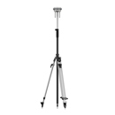
Picture does not represent the actual item
See what's in the box
Picture does not represent the actual item
See what's in the box
This item is no longer available.
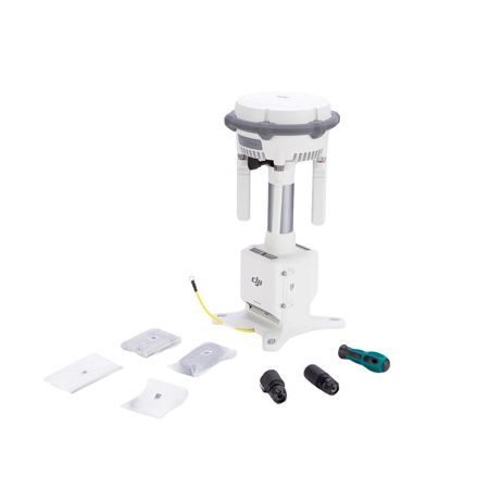
The new D-RTK 3 Multifunctional Station integrates high-performance antennas and receiver modules capable of tracking and resolving data from major global satellite navigation systems, and it supports multiple data transmission links. With these outstanding features, it can extend the operational range of drones in relay station mode.Relay Station Mode: Break Through Limitations
Switch D-RTK 3 to Relay Station Mode and set it up at an elevated location in areas with significant signal obstructions, such as urban environments or valleys. This will enhance the video transmission distance and extend the operational range of the Matrice 4 series up to 25 kilometers.
D-RTK 3 supports obstruction sensing with the Matrice 4 Series, allowing real-time calculations of obstructions and signal quality between the relay station, the remote controller, and drone. Operators can adjust the drone's position based on prompts from the remote controller to ensure optimal communication quality.
Effortless High-Precision Positioning
Stronger Performance, More Accurate Positioning
D-RTK 3 uses an air dielectric antenna with a filtering design, effectively tracking low-elevation satellites. The antenna phase-center accuracy is maintained within millimeter level, ensuring strong resistance to multipath interference and enabling high-precision positioning even in complex environments.
With its built-in receiver module, D-RTK 3 can receive satellite data from five major satellite systems across nineteen frequency points. Compared to network RTK, D-RTK 3 provides more accurate and stable positioning results under ionospheric effects.
Standalone Precise Point Positioning (PPP)
D-RTK 3 utilizes DJI's proprietary PPP solution, enabling satellite-based auto convergence. It provides free decimeter-level positioning even in challenging network conditions.
Network High-Precision Calibration
D-RTK 3 can receive RTCM data and automatically obtain coordinates and correct positions through the network. When used outdoors, it can achieve centimeter-level precision positioning without pre-measuring the setup point location.
DJI Integrated Mapping Solution
New DJI Enterprise App
Supports Ground Control Point (GCP) Setup and Tilt Compensation
Install the new DJI Enterprise app on an Android device to measure ground control point coordinates without third-party tools. When used with DJI drones supporting RTK, the DJI solution can efficiently complete an entire high-precision surveying workflow.
D-RTK 3 has a built-in high-precision inertial measurement unit, allowing the control point to be measured when the pole is held at an angle without a tripod or ensuring the base station is vertical, significantly improving operational efficiency in complex measurement environments.
Supports Projection Coordinate Conversion
The new DJI Enterprise app includes a mainstream projection coordinate database, allowing direct output of planar coordinates.
Compatible with DJI Terra for Efficient Data Processing
Supports Local PPK
D-RTK 3 supports recording raw satellite observations. When imported into DJI Terra version 4.4 or above along with data from the Matrice 4E, local PPK calculations can be performed with one click.