Welcome to the ultimate nature photography road trip, a visual journey around the desert southwest that shouldn’t be missed! In this, our second edition, we visit two national parks and a state part that offer stunning vistas and incredible details.
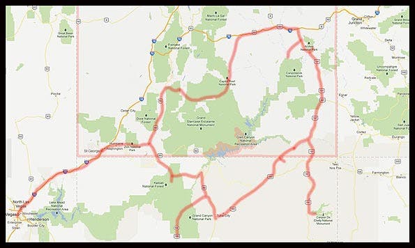
The Grand Circle is a vast region covering parts of five states – Utah, Arizona, Nevada, Colorado and, New Mexico. It contains America’s largest concentration of National Parks and Monuments all connected by hundreds (maybe thousands) of miles of roads designated as Scenic Byways. In part one of this article, we visited Valley of Fire State Park in Nevada and Zion National Park, Bryce Canyon, Cedar Breaks and Grand Staircase/Escalante in Utah. It’s so big, we’ve divided up our Ultimate Road Trip into multiple parts. There’s simply too much to digest in one bite!
In part two we visit Capitol Reef, winding our way past Goblin Valley State park to Canyonlands National Park. In the coming weeks, we’ll show how to photograph Arches, and Natural Bridges, in Utah. Then we will head into Arizona to visit Canyon De Chelly, Monument Valley Tribal Park and finally the Grand Canyon National Park (Both the North and South Rims).
Read Grand Circle, The Ultimate Nature Photography Road Trip part 1
Capitol Reef National Park
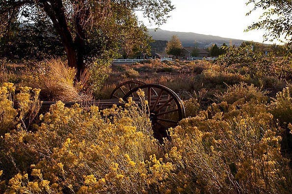
After leaving the Grand Staircase we continue on UT-12E for around 100 miles until it joins up with UT-24E and heads through Capitol Reef National Park. If you turn left, you are heading toward Torry, UT. It’s a quaint little town with its own scenic wonders. Be sure to keep a camera with you around here at all times. This photo was taken walking to dinner right across from my hotel.
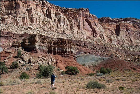
If you have elected to make this trip in the summer, it’s likely 90 degrees from late morning right through sunset. Then it will drop into the 50’s or low 60’s, so if you are camping, be prepared. One thing you rarely have to worry about here is rain. While the main park road that goes from the visitor center to the old homestead area is paved, if you go much beyond that it turns to dirt. It’s well groomed with little sand and few obstacles in the road so a passenger car can navigate over to the old uranium mines and down to the riverbed. There are great hike opportunities in the area too. And yes, you can take dirt roads out of here that lead back into Escalante. But you can get great photographs right from the paved park roads if you are not that adventurous.
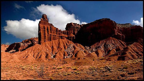
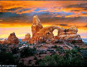
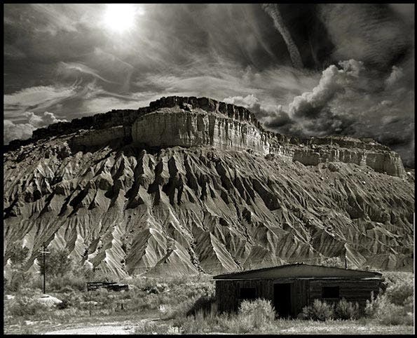
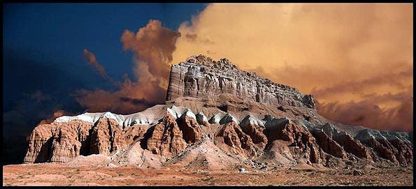
This photo is on the main high way right after entering the park boundary before you turn off to the visitor center. It’s the Capitol Reef. Across from it is an overlook of the canyon.
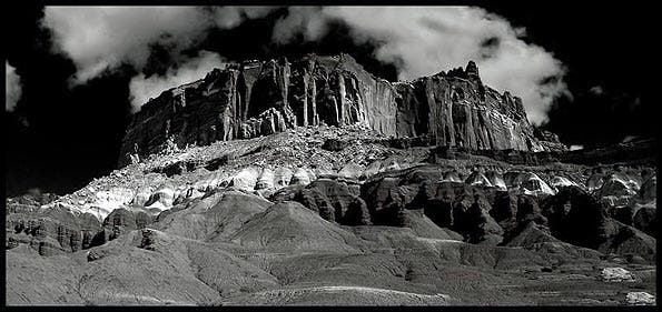
The drama here is captured equally well in Color and B&W. Both of these shots are panoramas made from multiple vertical shots seamed together in Photoshop. Both used a polarizer to darken the sky, and both were shot with longer focal lengths even though they
appear to be from wide angles.
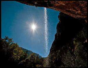
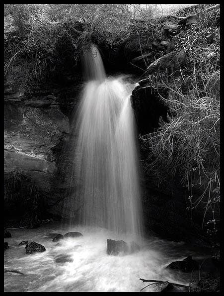
This was taken by my wife Sandie as I was shooting. A bit further down the road (after the turnoff for the visitor center) is a pullout on the left for a small water fall and a view of a large amount of petroglyphs. There is an apple orchard nearby where you can pick your own fruit.
While I only took a few snapshots of the petroglyphs, I took a lot of shots of what’s called “Desert Varnish”. The rocks seem to glow in a rainbow of colors due to this orange-yellow to black coating found in arid areas. When the rock is shaded but the sun is reflecting off the red rocks, it’s like an abstract painting. And when you add a polarizer to the mix, it’s magical.
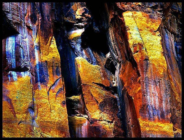
Desert Varnish, Capitol Reef National Park
Goblin Valley State Park
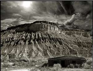
Our next stop is Goblin Valley State Park. This is a large collection of rock formations backed by some spectacular red and white mountains. This can be a day trip if you are spending several days in Capitol Reef, or a bit of an off track side trip on the way to Canyonlands. I prefer the latter. Head out from Capitol Reed on UT 24E till you get to Hanksville where you will join up with UT95. It’s about 45 miles down the road and you will see lots of photo ops along the way to this intersection. The desert scenery and abandoned buildings are plentiful. It’s a fairly deserted road so make sure you gas up, and check the car before heading out on it.
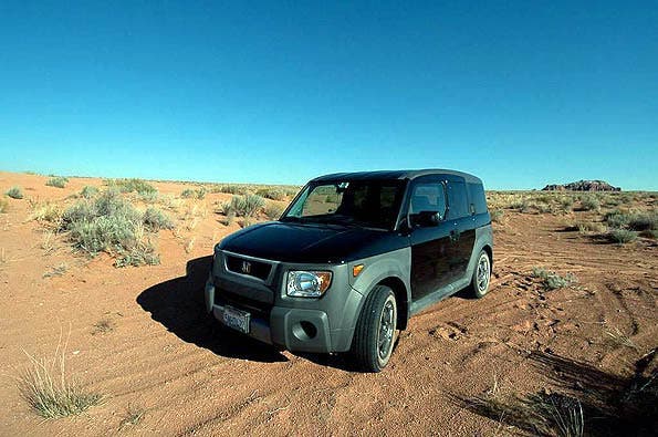
After that it’s a wide, long, empty road. Everything “scenic” is far in the distance. If you have a GPS, be very careful or it will lead you into the park through the back way. This is what the “road” looks like there. Even with my 4WD Honda Element, when I came to the sand dunes I stopped. You can see the signature mountain of the park in the distance. But that’s over a number of 2-6 foot sand dunes covering what was once a dirt road. I did shoot a lot of photos there. My wife modeled for me on the dunes as well, which turned an “oops” to a photo “op”. Turning around and heading on down UT 95 another 10 miles or so, we turned left on Temple Mountain road. About 5 miles down the road you will turn left on Goblin Valley Road. That leads past the pay station and into the park. The roadway here is small and you can hit the high points in a few hours unless you want to hike. Keep to the left and at the end of the road is the best vantage point of all the rock formations.
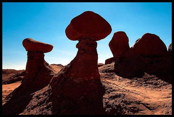
It’s an easy scramble down a sandy hill to walk among them. Very surreal and not to be missed, this is wide angle territory down here!
When you climb back out, look over the “goblins” to the mesa in the distance. Pull out your longest lens and go to work. It doesn’t seem possible these two shots could be had in the same area. Indeed, this one is under the shaded area at the top of the Goblin overlook.
Canyonlands National Park
Leaving Goblins State Park, we turn left back onto UT 24. In about 24 miles we merge onto the I-70E ramp towards Green River, UT. I’m usually playing Credence Clearwater Revival at that time; my wife says this annoys her and yet she always smiles when the song “Green River” comes on. Another 30+ miles down the road we will exit on US-191 S toward Moab. Just watch for the Arches/Canyonlands signs. If it’s getting late and you’d like to save a little $$, accommodations in Green river are considerably less expensive than in Moab. If you take this route, you can get up an hour or so before sunrise and head down US191 S to UT313W to hit one the most beautiful parts of Canyonlands, Mesa (also called Sunrise) arch.
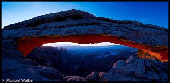
It is a short half-mile hike to the arch. Assuming you have arrived predawn, carry a flashlight because the terrain is not level, and expect to have a crowd there at this time of the day.
It’s a photographer’s dream subject. The only more iconic image of Utah is its nearby neighbor, Delicate Arch over in Arches National Park (which we’ll visit in Part 3).
A Quick Photoshop Detour
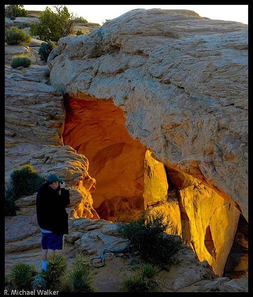
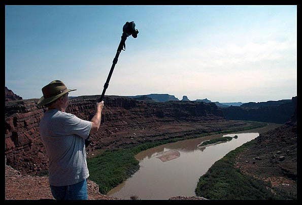
My wife Sandie got the shots abpve as I was shooting the handheld panoramic shoot above. I’m using a Nikon 24-120mm f/4G Nikkor lens on my Nikon D300s and shooting a number of shots to seam together in Adobe Photoshop. Ilford sponsors me, and they often use my work in ads and promotional brochures. At shows like Photokina, their booth showcases my work and the prints range from 17×22 to prints that are close to six feet tall.
Because of this, the files need to have as much detail as possible. While I feel my current digital camera equals the quality I got when I used to shoot Medium Format, there are a few limitations I need to work around when blowing it up that large. I don’t just want prints that are large; I want large prints that look good too. No flaws, no anomalies. And I want to see detail in those rocks. These prints are not large because they need to be seen at a distance like some roadside billboards. They are large because they look great that way, especially printed on ILFORD GALERIE Gold Fibre Silk inkjet paper. But that’s a story for another time.
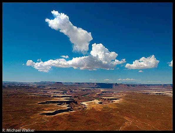
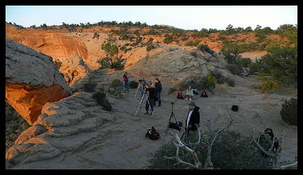
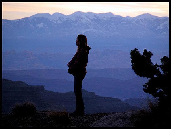
The opening image for the park was shot at the “Island in the Sky” overlook. It’s another favorite spot. And while it looks good pretty much all day long, I like the contrast created when the light is at a lower angle. In that shot I got lucky with the clouds. It looks like they just drifted up out of the canyon. They mirror the shape of the crevice below them. It was shot with a longer lens to pull the mountains in the background closer.
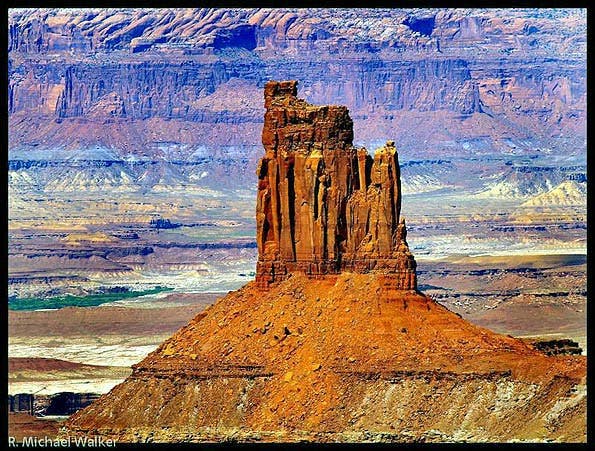
This image was taken with a Nikon 400mm lens to pull the distant hills even closer. From the vantage point, this mesa was barely visible to the naked eye. Ilford uses this image in their new paper brochure. There are many other great photo spots, but if we want to get over to Delicate arch by sunset we need to head out now. The shortest way between the parks, not to mention the most interesting, is down a winding 4WD dirt road that is definitely not recommend for passenger vehicles. I’ve seen a few down there so it can be done, but you might want to stick to the paved roads if you don’t have 4WD. It’s called Shafer Canyon Road (CO Rd 142).
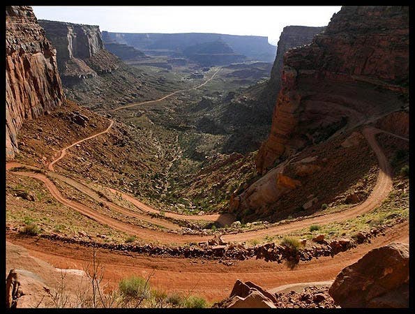
This leads to the White Rim Road, 100 miles of dirt road that circles through Canyonlands. It also passes by the river bend you see from Dead Horse Point State park. If you do take this way, you can bypass that park and it’s additional entrance fee because you will get a better, closer look a the river bend. And if you are as afraid of heights as I am, your monopod and self timer can act as a boom pole to reach out over the edge from a safe distance.
Aside from connecting up with White Rim Road, it also eventually joins up with UT272. Turn left on it and you are heading to Moab. It dead ends back on US-191. The entrance to Arches is on the right just a short distance up the road. This is our destination. If you didn’t opt to take this route and headed back down 313 to US-191, Arches will be on your left.
Coming in Part 3: Arches National Park and much more!