


+2
more
more
This item is no longer available.
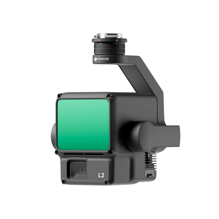
Find unparalleled precision with the Zenmuse L2 - a high-precision aerial LiDAR system designed to elevate the accuracy and efficiency of geospatial data acquisition. The Zenmuse L2 is a formidable integration of frame LiDAR technology, a proprietary high-accuracy IMU system, and a 4/3 CMOS RGB mapping camera. This advanced payload is engineered to augment DJI flight platforms, enabling the capture of more precise, efficient, and reliable geospatial data.
When paired with DJI Terra, the Zenmuse L2 becomes a powerhouse for 3D data collection and high-accuracy post-processing, providing a comprehensive turnkey solution. Its robust hardware supports an extended range for precise scanning of complex subjects and expedites point cloud acquisition. The ability to preview, playback, and process point cloud models directly on-site, along with Task Quality Reports generated by DJI Terra, streamlines operations and significantly boosts overall efficiency.
The Zenmuse L2 boasts exceptional precision, achieving 4cm vertical and 5cm horizontal accuracy through the fusion of GNSS and a high-accuracy IMU. Its readiness for immediate deployment upon power-up allows for the collection of both geospatial and RGB data over a 2.5km area in a single flight, demonstrating remarkable efficiency.
Operation is intuitive, especially when used in conjunction with the Matrice 350 RTK and DJI Terra, lowering the operational threshold and simplifying the user experience. The frame-based LiDAR design of the Zenmuse L2 offers a 30% increase in detection range, capable of reaching up to 450 meters, and supports an operational altitude of up to 120 meters, enhancing both safety and operational efficiency.
The Zenmuse L2's reduced laser spot size and denser point clouds allow for the detection of smaller objects and improved penetration through dense vegetation, resulting in more accurate digital elevation models (DEM). With support for 5 returns, the L2 excels in capturing ground points beneath foliage, and with an effective point cloud rate of 240,000 points per second, it ensures comprehensive data collection in both single and multiple return modes.
Flexibility is key with the Zenmuse L2, offering two scanning modes to cater to different task requirements. The repetitive scanning mode is ideal for uniform and accurate point clouds, while the non-repetitive scanning mode provides deeper penetration for structural information, making it suitable for a variety of applications such as power line inspection and forestry surveying.
The frame-based design ensures an effective point cloud data rate of up to 100%, and the three-axis gimbal expands the possibilities for surveying scenarios. The high-accuracy IMU system delivers precise absolute position, speed, and attitude information, enhancing the accuracy and reliability of the Zenmuse L2.
The RGB mapping camera, with its 4/3 CMOS sensor and mechanical shutter, captures high-quality imagery with a pixel size of 3.3 microm and 20 MP effective pixels. The camera's fast photo interval and high shutter count reduce operational costs and allow for versatile data collection even when point cloud collection is not required.
The Zenmuse L2 enhances the operational experience with diverse flight route types and Point Cloud LiveView, offering intuitive displays and real-time point cloud coloring modes. The ability to view and merge 3D point cloud models post-operation, along with the auto-generated Task Quality Report, empowers on-site decision-making and ensures a responsive fieldwork experience.
For complex operational environments, the PPK solution provides a safeguard against data loss, and the one-click processing on DJI Terra streamlines the post-processing workflow. The Zenmuse L2 is adept for a multitude of applications, including land surveying and mapping, electricity management, forestry management, and infrastructure management.
The accompanying Care Enterprise Basic plan provides comprehensive protection for your DJI Enterprise products, offering coverage for accidental damage with unlimited replacements or free repair services. This service ensures peace of mind and extends the life of your DJI fleet with comprehensive after-sales services, accidental damage coverage, an official warranty, and two replacements for added security. Enjoy the convenience of free shipping for any replacement service, with DJI covering the costs both ways, subject to the scope of coverage.
The Zenmuse L2 LiDAR Payload with 2-Year Care Enterprise Basic is a testament to DJI's commitment to innovation and excellence in the field of aerial surveying technology, offering an unmatched combination of precision, efficiency, and protection.
https://www.dji.com/service/policy
818-235-0789